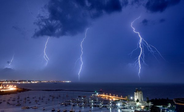
The Uruguayan Institute of Meteorology (Inumet) The weather warnings ceased at 9:30 p.m. on Tuesday.while the Argentine body (National Meteorological Service –SMN–) earlier raised the risk level for storms to red for the Province of Buenos Aires. Then the Inumet issued a yellow alert for strong storms.
The Inumet reported at night that “the atmospheric conditions that caused the issuance of alerts for strong storms” had “temporarily improved”so it was determined “the cessation of the current alert”. He added on his website that “monitoring of the situation is maintained and if necessary new meteorological alerts will be issued”.
At the same time, a red alert for storms was in force, according to the Argentine SMN, for the Province of Buenos Aires. That alert came into effect around 7:30 p.m. this Tuesday, and at night, it remained in effect for General Alvear, General Belgrano, General Paz, Las Flores, Lobos, Monte, Navarro, Roque Pérez and Saladillo.
predicted then severe storms for the center of the Argentine capital, with gusts that could exceed 90 kilometers per hour, and hail “of various sizes tonight (for Tuesday)”.
When the alert rises to red -reports the SMN- it is because “Exceptional weather events with the potential to cause emergencies or disasters are expected”.
After remaining without alerts for a few hours, the Inumet warned again, this time with a yellow alert, which it would update later, at 4:00 a.m. on Wednesday.
Both organizations updated their alerts in a context in which Metsul disseminated a special warning to the population, about the possibility of the “most dangerous storms in years”. He even warned about a high probability of tornadoes, which could be generated in Argentina and Uruguay.
Dozens of users on social networks published images – in photos and videos – about the electrical storm that could be seen in the sky, in Montevideo. Meanwhile, in Argentina they did the same, in areas that had the same forecast, but with different intensity. In addition, there were jokes and complaints regarding the difference in the forecasts that were issued in the countries –also taking into account Brazil with the Metsul warning–.
The forecast consulted around 11 p.m. indicated that at night there would be an increase in cloudiness, with precipitation and probable storms. Overcast to cloudy and somewhat cloudy skies, with precipitation and storms at dawn and part of the morning of Wednesday.
On the other hand, Inumet issued an announcement early in the day –which it kept identical– in which it reports a “deterioration” in the weather conditions on the west coast of the country, which would move towards the rest of Uruguay.
From early this Wednesday there will be “strong and punctually severe storms” that will begin to advance from the southwest to the north of the country.
“In storm zones they will be able to register heavy rains, occasional hail, intense electrical activity and very strong gusts of wind”Add.
The situation includes “a marked drop in temperatureswhile on the northern border the rains and storms –some punctually strong– until the afternoon of Thursday 28, he adds.
“We will continue to monitor the situation and if necessary, the corresponding meteorological alert level will be issued,” adds Inumet.


