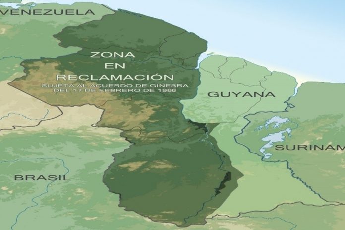
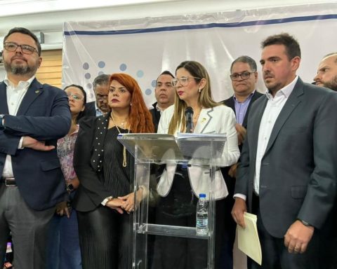
The My Map of Venezuela account includes the Essequibo on Twitter and Facebook was created 13 years ago to provide information on the territorial claim that Venezuela has against Guyana for the dispossession of 159,542 km2 that historically belong to the country.
“The organization was born in 2010, because before I was searching the networks about the dispute and there was very little information, only articles on Wikipedia and the occasional blog. In addition to that, I saw many versions of the mutilated map”, explains Jorge Fuguet, founder and administrator of the account.
Fuguet comments that at first the objective was to use the social network to call attention to the border issue with Guyana and also provide information to the public. “Then we began to have contact with government and private organizations, as well as ambassadors,” he mentions.
From these relationships they went on to hold forums and workshops and even “we have had the joy of doing field work on the de facto limit, in Essequibo towns to find out how people live there.”
selective
Jorge Fuguet affirms that in their 13 years they have managed to have coordinators in the states of Venezuela and abroad, but that they are very rigorous in the selection of new members.
“We are selective because we have to look for people who, without being scholars, have mastery of the subject. They must have a basic preparation, good vocabulary, knowledge, who likes to investigate and who contribute ideas in a concise, civic, legal and constitutional way. Nothing to go around the bush, calls for war and protests or demonstrations, ”he points out.
The coordinator of My map of Venezuela includes the Essequibo adds that “our north is the east of the country, and what we do is based on the ethics of a matter of State, where everyone fits regardless of their partisan preferences, but they like the subject, that is nationalist, democratic, and that contributes initiatives”.
They invite us to follow the path to the east, which, they maintain, is a very little-known area and “one of our tasks is to make all of this known. That it is not understood that this is mountain and snake or some stripes painted on the floor, no, it is a region rich in natural resources, in people who do not know what the border issue is, but who live from their day to day, from their work local, which really need to be taken into account”.
The organization is not exclusive and, on the contrary, they add up as a strategy to involve everyone in the defense of the Essequibo.
We have not sat down with representatives of all the political parties, because this is a political issue but not partisan, it is in the interest of the State that is led by a government that represents us and that is recognized in the United Nations Organization. And it is through the government that we can do things”, clarifies Fuguet.
In the organization Mi Mapa they maintain that educating so that Guyana is known to be differentiated from Guyana Esequiba or Essequibo territory is a priority.
“There are 159,542 square kilometers that belong to us and that were vilely usurped under a totally arbitrary award in 1899, under a compromise of the empires of that time and we have to show that Venezuela is asserting its rights,” he says.
“We have lost 40.9% of the original territory of the Captaincy General of Venezuela and the only recoverable area, unfortunately, is the Essequibo territory. The rest is already lost. And that is where we have to focus so that the legacy of those who began this defense, from El Libertador in 1822 to today’s sun, can be settled based on the truth and the history that accompanies us.”
Fuguet says that “it is necessary to make the issue Venezuelan to present it in the press, because many times they copy and paste media that are in favor of Guyana and distort the information.”
