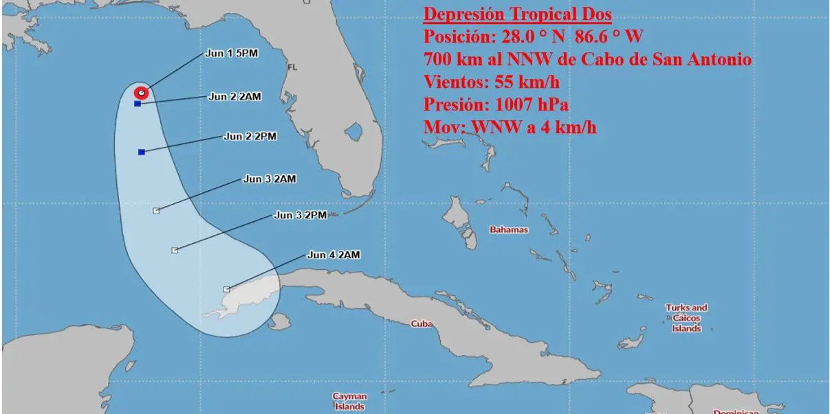
MIAMI, United States. – Tropical depression number two arose in the northeast of the Gulf of Mexico, according to reports from the United States National Hurricane Center (NHC) and the Cuban Institute of Meteorology (INSMET). The meteorological system could impact the westernmost region of Cuba in the coming days, according to the forecasts of both scientific institutions.
According to the NHC, the depression is located approximately 520 kilometers north of Dry Tortugas and 490 kilometers west-northwest of Ft. Myers, Florida. The depression is moving toward the west-northwest at a speed of 4 km/h, with maximum sustained winds near 55 km/h. It is expected to begin a southward motion on Friday with a gradual increase in forward speed.
The tropical depression could intensify into a tropical storm by tonight or tomorrow. However, it is expected to begin to weaken by Friday night and become a remnant low by Saturday.
INSMET has also been monitoring this systemwhich is located 700 kilometers north-northwest of Cabo San Antonio, Pinar del Río.
Although the environmental conditions are not entirely conducive to its development, there is a possibility that it could gain intensity and reach the category of tropical storm during the next morning. This process, however, is expected to be short and the depression will weaken in less than 24 hours.
Although the system is currently in disarray and expected to be short-lived, authorities urge residents of western Cuba to pay attention to updates on this depression due to its proximity and future trajectory.
Rainfall amounts of one to three inches, with localized higher amounts of up to six inches, are possible through Saturday in portions of central and southern Florida. This rainfall could result in isolated impacts from flash, urban, and small stream flooding.


