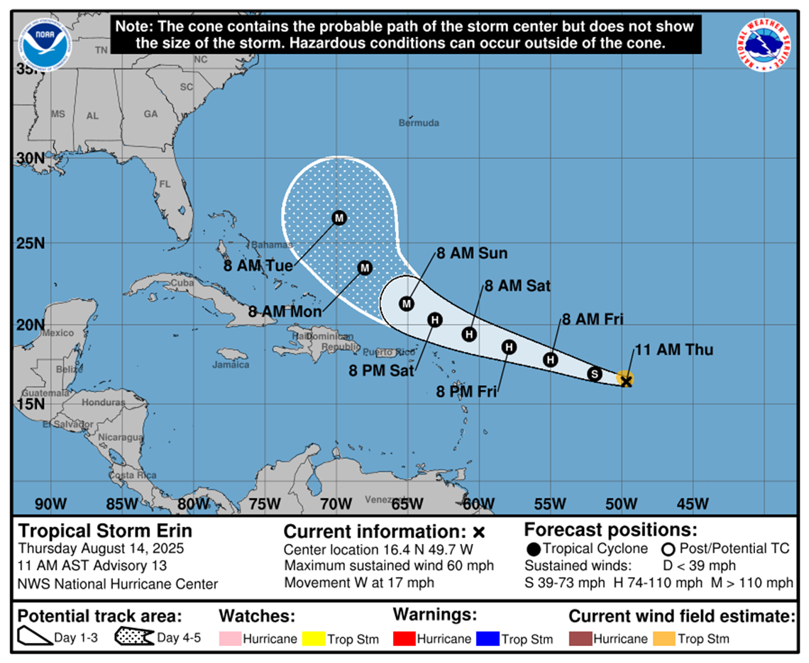
Tropical storm Erin continues to strengthen in the Atlantic with Maximum sustained winds of 95 km/h and more intense bursts.
According to the forecasts of the National Hurricane Center for the United States (NHC), the system I could become a hurricane this Friday and reach great intensity During the weekend.
In the last hours, Erin has maintained a more west trajectory, which increases the risk for the northern group of the Minors and Puerto Rico.
The meteorologist Raydel Ruisanchez warned that this route raises the probability of Winds with tropical storm force, torrential rains and dangerous swells.
According to the NHC, at 11:00 am AST (15:00 UTC) the Erin center was in the latitude 16.4 N and length 49.7 or, moving at 28 km/h in the west direction.
A is expected turn to the west-norbest during the nightmaintaining that displacement until the weekend.
Winds with tropical storm force extend to 95 km from the center.
As for the swells, these will begin to affect the north of the Sotavento Islands, the Virgin Islands and Puerto Rico in the next few days.
According to the National Hurricane Center, the swells could generate dangerous marine currents and elevated waves.
The authorities They urge the population of the region to keep the official notices attentive and to prepare security measures Before the possible impact of Erin.


