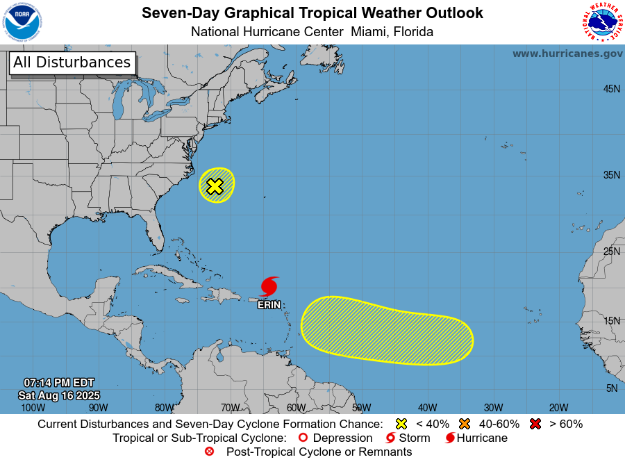
Santo Domingo.– The National Meteorology Institute (INDOMET) predicted this Saturday that, as a consequence of the indirect effects of Hurricane Erin, this Sunday is They will register moderate to strong downpoursaccompanied by thunderstorms and winding gusts in the provinces La Altagracia, Espaillat, El Seibo, Santo Domingo, Puerto Plata, Hato Mayor, Montecristi, Samaná, María Trinidad Sánchez and in the National District. All these demarcations remain on green alert.
On the Atlantic coast, from Cape Decoño to Montecristi, as well as on the Caribbean Coast, from Isla Saona to Cabo hoax, waves that could reach up to 12 feet are expected.
You may also be interested:
Both INDOMET and the Emergency Operations Center (COE) recommended that boat operators remain in port, due to strong winds, abnormal waves and reduced visibility.
“The use of beaches and the practice of aquatic sports on the Atlantic coast are prohibited, from Altagracia to Montecristi,” warned the director of the COE, retired general Juan Manuel Méndez. He also reiterated that the population should not approach coastal areas due to the danger of dizziness high.
Hurricane movement
Hurricane Erin reached on Saturday category 5 on the Saffir-Simpson scale, with maximum sustained winds estimated at 255 kilometers per hour.
According to the newsletter issued yesterday at 5:00 in the afternoon by the National Hurricane Center (NHC), the phenomenon was in the north and western Longitude 64 latitude, about 170 kilometers north of the island of Anguilla, moving west at a speed of 28 kilometers per hour.
Méndez reported that, due to the situation, COE activated its response institutions, including civil defense, mayors, and the Ministries of Defense, Public Health and Public Works.


