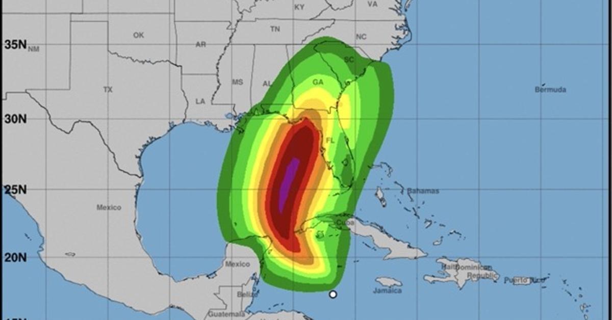
Madrid/The US National Hurricane Center (NHC) is monitoring a tropical cyclone, the ninth of the season, which could become a hurricane in the next few hours and affect western Cuba. In an alert issued this Monday at two in the afternoon, the institution details that they have active hurricane watch for southeastern Mexico (from Río Lagartos, in Tabasco, to Tulum, in Quintana Roo) and the Cuban provinces of Artemisa, Pinar del Río and Isla de la Juventud.
Maximum sustained winds are estimated at around 45 kilometers per hour (km/h), with higher gusts. Strengthening is expected during the next few days as it moves across the eastern Gulf of Mexico, becoming a hurricane, with a 90% probability, by Wednesday.
Maximum sustained winds are estimated at around 45 kilometers per hour (km/h), with stronger gusts.
The NHC explains that the cyclone, located south of the island, is moving north at about 9 kilometers per hour (km/h), and will move northwest on Tuesday, before another faster movement north or north-northeast between Wednesday and Thursday.
In terms of rainfall, the forecast is for the cyclone to produce accumulations of rain in western Cuba and the Cayman Islands, with a risk of “flash and urban flooding and minor river flooding.” The storm will extend to the southeastern United States starting Wednesday and continuing through Friday.
They also issued a storm surge alert, which could raise tide levels along the southern coast of Pinar del Río, including the Isla de la Juventud.
So far, the Cuban Meteorological Institute has not published any warning on its website.


