The heat wave in the city of Buenos Aireswhich was one week old, ended this Tuesday, although the district continues to be under red alert due to extreme temperatures, as are some municipalities in the Buenos Aires suburbs, while a decrease in thermal marks is expected for Friday, reported the National Meteorological Service (SMN ).
“For there to be a heat wave, there must be a minimum of three consecutive days with minimum and maximum temperatures at certain thresholds, which varies in each district. In the city of Buenos Aires, the minimum must exceed 22 degrees and the maximum, the 32. But the minimum was just 21.8,” SMN meteorologist Cindy Fernández told Télam, to explain the end of this phenomenon.
A heat wave is an excessively hot period, which can have a mild to very high impact on health, especially for risk groups, such as boys and girls, and those over 65 with chronic diseases such as cardiovascular, respiratory, diabetes and obesity.
Although the heat wave in the city of Buenos Aires has just ended, sweltering temperatures will continue, with highs forecast to be around 33, 34 and 36 degrees through Friday when they are expected to drop slightly after the southerly wind rotates.
In addition to the Buenos Aires district, the Red alert applies to the Buenos Aires towns of Esteban Echeverría, Ezeiza, La Matanza, Merlo, Brandsen, Cañuelas, Magdalena, San Vicente, Berisso, Ensenada, La Plata, Almirante Brown, Avellaneda, Berazategui, Florencio Varela, Lanús, Lomas de Zamora, Presidente Perón and Quilmes.
In addition, the center and west of the province of Entre Ríos and the north of Buenos Aires present orange alerts by extreme temperatures, which can be “very dangerous, especially for risk groups”, while in the center of Córdoba and a large part of the center and east of Buenos Aires are under yellow alert, with an effect “from slight to moderate in people’s health”.
In the case of the capital of Entre Ríos, a maximum of 34 degrees is forecast for the day and in the city of Córdoba 33 degrees are expected.
Starting next Friday there will be a slight drop in temperatures that will last until Saturdaybut on Sunday the high thermal marks will return.
“This Friday a slight drop in temperatures is expected as a cold front will advance during the day that will cause the wind to rotate south and temperatures drop a bit,” Fernández explained.
And he explained that “with this front a little drier air will enter, the environment will become a little less annoying and there may be some passing showers, but temperatures can reach up to 30 degrees” in the city of Buenos Aires.
“This relief will be on Friday and Saturday and by Sunday the north wind returns and temperatures rise with maximums between 32 and 35 degrees,” he warned.
Meanwhile, the central strip of Argentina will present “a lot of heat until Thursday, because with the south wind they will drop a bit, but on Saturday with the north wind the temperatures will rise a lot again,” he explained.
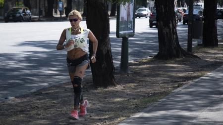
The Ministry of Health reiterated a series of recommendations due to high temperatures, such as the use of sunscreen, hydration, drinking water even when you do not feel thirsty, wearing loose clothing, avoiding exposure to the sun, wearing a hat, eating fruits and vegetables, and avoiding intense physical activity.

Alerts for storms in the north of the country
The SMN issued alerts for storms of varying intensitysome of which may be locally strong, for towns in Salta, Jujuy, Formosa, Chaco and Santiago del Estero, it was officially reported.
The storms can be accompanied by intense gusts, occasional hail, strong electrical activity and mainly abundant rainfall in short periods, the meteorological agency indicated.
Low Orange alert they are the east of Salta, with districts like La Candelaria and Rosario de la Frontera, among others; and the northwest of Northwest of Almirante Brown and General Güemes, in Chaco.
The rest of both provinces are under yellow alertlike Formosa, south of Jujuy and north of Santiago del Estero.
Accumulated precipitation values between 40 and 90 millimeters are expected for the orange alert area, and between 20 and 50 millimeters for the yellow warning areas.
The SMN recommended that the inhabitants of the affected localities avoid outdoor activities, not take out the garbage and remove objects that prevent water from draining, and not take refuge near trees and electricity poles that could fall. In addition, to minimize the risk of being struck by lightning, they advised not to stay on beaches, rivers, lagoons or pools.
