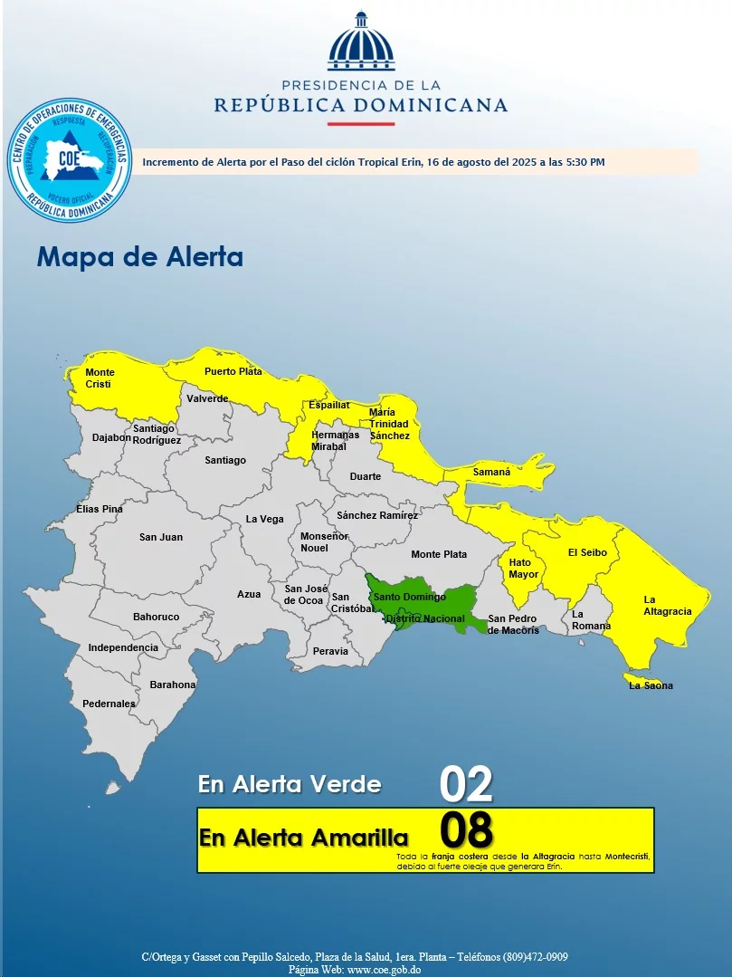
Santo Domingo. – Given the effects of the Hurricane Erin About national geography, the Emergency Operations Center (COE) reported that it keeps 10 provinces under alert for possible floods of rivers, streams and ravines, as well as sudden or urban floods.
The entity placed in Green alert to Santo Domingo and the National District, while In yellowAltagracia arranged, Hato majorMaría Trinidad Sánchez, Montecristi, El Seibo, Samaná, Espaillat, and Puerto Plata.
Erin has intensified to a Powerful hurricane category 5while traveling through the hot Caribbean waters.
According to him Dominican Institute of Meteorology (INDOMET)the atmospheric phenomenon will sometimes produce a cloudy sky with Local downpoursthunderstorms, wind bursts and dangerous waves, especially in the provinces of the northern coast of the country, as in AltagraciaEl Seibo, Hato Mayor, Samaná, María Trinidad Sánchez, Espaillat, Puerto Plata and Montecristi.
For other locations, the entity argues that local downpours will be generatedthundered and wind
Accelerated, mainly in Santo Domingo, Monte Plata, Santiago, La Vega, and Monsignor Nouel.
Recommendations
Due to the indirect effects of Hurricane Erin, The COE urges all vessels to remain in Puerto by windabnormal waves and reduced visibility, from Cabo deception (Altagracia) to
Montecristi and Saona Island.
Meanwhile, he indicated that on the Caribbean coast you can navigate but with due caution.
The emergency operations center also indicated that The use of beaches and aquatic sports is prohibited on the Atlantic coast from Altagracia to Montecristi.
He also reported that the population is not allowed to approach the coast to observe the strong waves, due to the danger that this action implies.


