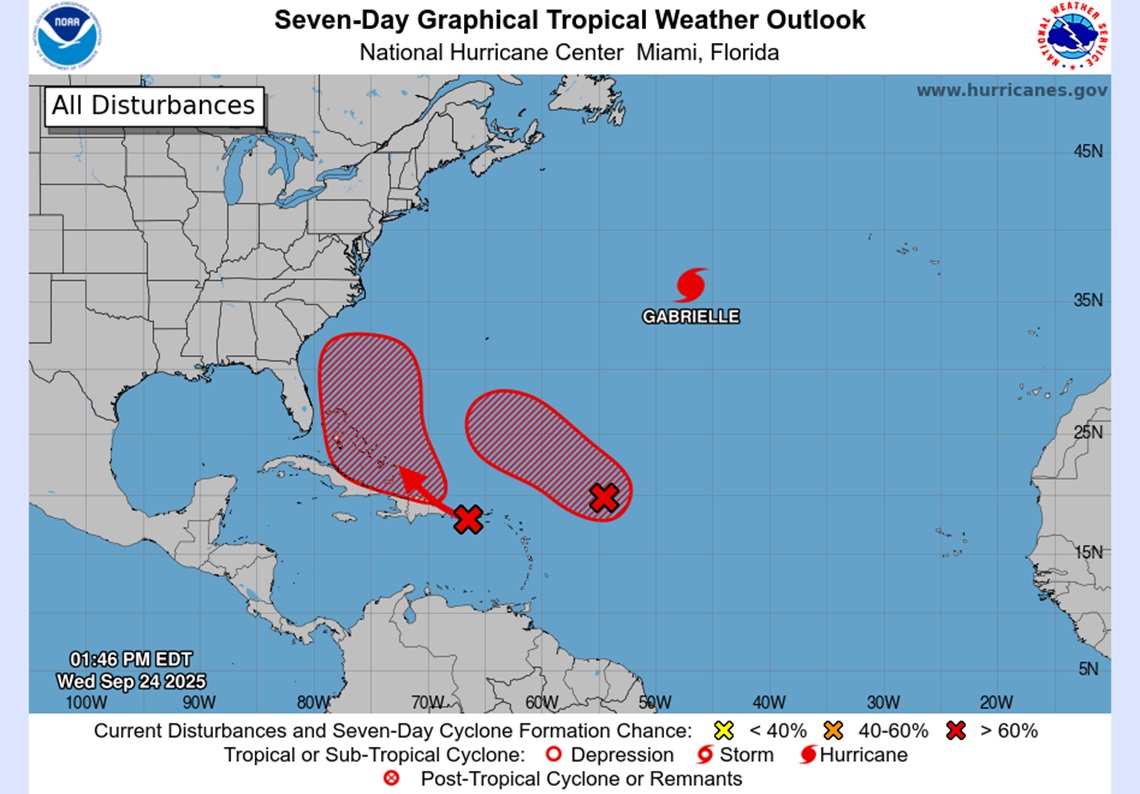
A tropical wave in the Northeast of the Caribbean Sea keeps several territories of the region under surveillance, as it is generating intense rains and disorganized electric storms that could be transformed into a stronger system With cyclonic potential in the next few days, the National Hurricanes Center (NHC).
The phenomenon travels to the west-northwest to between 15 and 20 mph (24–32 km/h).
Today: rains and wind bursts are expected in Puerto Rico and the Virgin Islands.
Tonight: bad weather will reach the Dominican Republic.
According to forecasts, the wave will lose speed towards the end of the week and It could be organized when reaching the southwest of the Atlantic, in the direction of the Bahamaswhere environmental conditions will be more favorable for strengthening.
Experts do not rule out that they become Tropical depression In that Caribbean area.
The authorities recommend the population of Virgin Islands, Puerto Rico, Dominican Republic, Turkish Islands and Caicos and Bahamas stay attentive To the weather.
An aircraft hunting of the US Air Force could inspect the system this afternoon, if it is considered necessary, to collect key information about its evolution.


