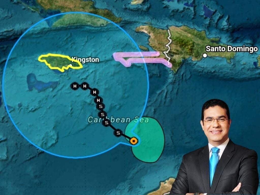
Santo Domingo, DR. – The meteorological analyst, Jean Surielassured that the storm Melissa that affects the Dominican territory could intensify in the next 24 to 48 hours.
According to Suriel, the phenomenon that has remained stationary in the waters of the Caribbean Seaabout 460 kilometers southwest of Pedernales, moving at only 4 kilometers per hour, will gain greater intensity, while it could develop a route towards Jamaica.
The analyst meteorological He said through his “X” account that the forecasts foresee little displacement during the next three days, so the Dominican Republic will mainly receive indirect effects of the phenomenon.
You may be interested in reading: Heavy rains from Storm Melissa will be felt starting Friday in the DR
Cloud fields generated by Melissa
Another effect that Storm Melissa will leave behind is the significant cloud cores that are moving towards the southern coast of the Dominican territory, which increases the potential for significant downpours in the coming hours.
Suriel added that for Wednesday afternoon, an increase in sudden and urban flooding is expected, as well as flooding of rivers and ravines, with possible overflows in the South, East and Southwest regions of the country.
Hurricane Risks
The analyst highlighted that it is not ruled out that Melissa could become a powerful category 4 or 5 hurricane south of Jamaica, due to the fact that the waters of the Caribbean Sea They are at very high temperatures.
Rain extension alert
Finally, Jean Suriel warned not to let our guard down in the face of alerts and prevention measures, since the greatest danger for the Dominican Republic will be the external cloud bands of Melissa, which will extend the rainy periods until Sunday in much of the country.


