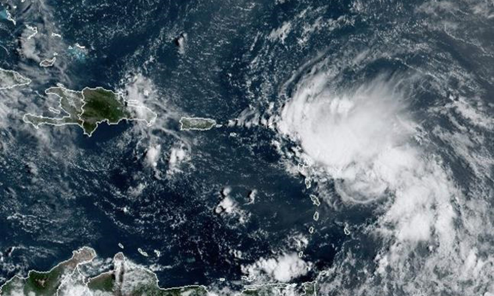
The National Meteorology Office (Onamet) reported yesterday that it is monitoring several natural phenomena, one of which, located in the central tropical Atlantic, may become a cyclone in the coming days and affect the Windward Islands and parts of Venezuela.
According to the authorities, the system located to the east-southeast of the southern part of the Windward Islands (Grenada, Martinique, Saint Lucia, Barbados, Guadeloupe, Dominica, Trinidad and Tobago, among others), has 70% probability of being a named storm in 48 hours and 90% in 5 days.
In addition, Onamet reports two areas of downpours and thunderstorms, the first to the north of the Gulf of Mexico, associated with a low with a potential below 10% to become a tropical cyclone in the next 48 hours. Due to its position, this phenomenon does not pose a danger to the country. The second, a tropical wave in the Central Atlantic with low potential in 48 hours.
While at the local level, the passage of the tropical wave to the south of the country is announced, which will cause some local downpours, isolated thunderstorms and gusts of wind to the northeast, southeast, southwest, the Central Mountain Range and some points in the border area.
In the face of the tropical wave, the Emergency Operations Center (COE) issued a green alert for the provinces of Monte Plata, San Cristóbal, Hato Mayor, Sánchez Ramírez and Greater Santo Domingo, where significant rainfall is expected due to heavy rains in the mentioned regions.
A mostly sunny sky with little cloudiness and an opaque appearance is forecast for tomorrow, due to the incidence of an air mass with low moisture content, Saharan dust particles and the permanence of the anticyclonic system.
As for temperatures, they will stay hot.


