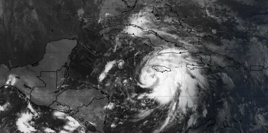
MIAMI, United States. – Tropical Storm Rafael gained in organization and intensity during the early hours of this Tuesday, so it could reach hurricane status near the Cayman Islands, according to the Institute of Meteorology (INSMET) of Cuba and the National Hurricane Center (NHC) of the United States.
Rafael’s maximum sustained winds have increased to 95 kilometers per hour, with higher gusts, and the minimum central pressure has decreased to 993 hectoPascal. At 6:00 am, the center of the storm was located at 17.3 degrees North latitude and 77.8 degrees West longitude, a position that places it about 160 kilometers southwest of Kingston, Jamaica, 405 kilometers southeast of Grand Cayman and 670 kilometers southeast of Punta del Este, Isle of Youth.
“In the next 12 to 24 hours, this system will continue moving with a similar course and speed, approaching the vicinity of Jamaica,” INSMET indicated in its statement. Tropical Cyclone Warning No.4. “During its movement it will continue to gain in organization and intensity and could reach the category of hurricane near the Cayman Islands.”
The NHC, in its 7:00 am bulletin, noted that “Rafael is moving northwest about 20 km/h. A generally northwesterly movement is anticipated over the next few days.” In addition, it warned that “steady to rapid intensification is forecast over the next 24 to 36 hours, and Rafael is forecast to become a hurricane in the northwest Caribbean near the Cayman Islands with additional strengthening before it hits. land in Cuba.”
Given this situation, Hurricane Warnings have been issued for the Cayman Islands and the Cuban provinces of Pinar del Río, Artemisa, Havana, Mayabeque, Matanzas and the Isle of Youth. Likewise, Jamaica and the provinces of Villa Clara, Cienfuegos, Sancti Spíritus and Ciego de Ávila are under a Tropical Storm Warning. The provinces of Camagüey and Las Tunas are under Tropical Storm Watch.
“Rains, showers and thunderstorms will continue in the eastern and central regions, which may be strong and intense in some locations. The rainfall will later extend to western Cuba,” INSMET warned. The effects of the wind and the sea will depend on the trajectory and intensity that this cyclonic organism reaches.
The NHC also highlighted that “heavy rain will affect areas of the western Caribbean until early Thursday, particularly across Jamaica and the Cayman Islands in southern and western portions of Cuba, where rainfall totals of between 75 to 150 millimeters are expected, with isolated accumulations of up to 250 millimeters in mountainous areas.”
In addition, there is a warning of possible coastal flooding. “The storm surge could raise water levels (…) up to six to nine feet in areas of onshore winds along the southern coast of Cuba,” the NHC specified.
Meteorological authorities urge the population to stay informed and pay special attention to the guidance issued. “Taking into account the current position and future trajectory of this organization, the greatest attention must be paid to its evolution, the possible impacts on the national territory and the information issued by the Forecast Center of the Institute of Meteorology,” INSMET stressed. .


