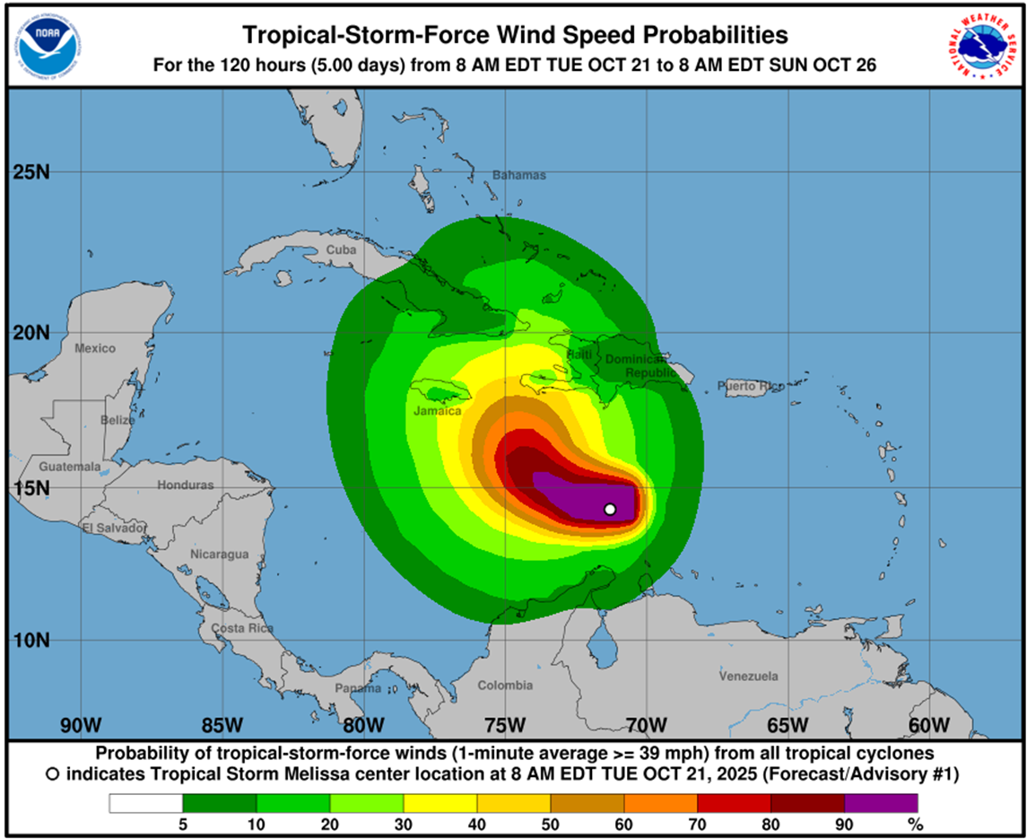
Melissa, tropical storm number 13 of the current hurricane season, formed this Tuesday morning over the central Caribbean Sea, and according to specialist projections it could become a hurricane over the weekend, near Jamaica and Haiti.
At 11 a.m. today, its location was about 480 KMS from Port-au-Prince, Haiti, and its maximum sustained winds reached 85 KM/H. It was moving at 22 KM/H, according to the United States National Hurricane Center (NHC).
OCT 21: Dr. Michael Brennan provides a LIVE update on the tropics and newly formed Tropical Storm #Melissa from the National Hurricane Center: https://t.co/RBje6I27La
Full details at: https://t.co/sYVOB3gScg
— National Hurricane Center (@NHC_Atlantic) October 21, 2025
According to this center’s projections, a decrease in forward speed and a gradual turn to the northwest and north is expected over the next few days.
On the forecast track, Melissa is expected to approach the southwestern portion of Haiti and Jamaica later this week.
In its first warning by this organization, the Forecast Center of the Institute of Meteorology (Insmet) maintains close monitoring of the evolution and trajectory of this system given its position and the time of year.
“Oceanic and atmospheric conditions will become more favorable for its intensification, which is why it represents a potential danger for the region,” Insmet reported.
Alerts for a cyclonic event that may affect Cuba: “A potential danger,” says Rubiera
When it was just a disturbance, Cuban meteorologist José Rubiera warned that its advance through the waters of the Caribbean had to be observed “very carefully” due to its possibilities of development, which would make it a “dangerous” phenomenon.
The specialist highlighted the translation speed with which this disturbance moved over the arc of the Lesser Antilles, and the forecasts on its possible trajectory, according to the application of several forecast models.
