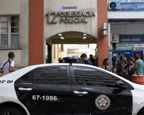
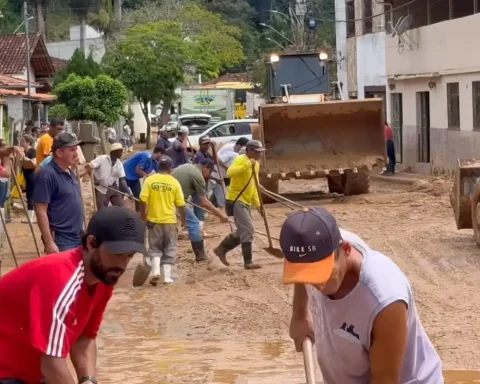
A study recently published by the collaborative network of non-governmental organizations (NGOs) MapBiomas shows that Manaus is the city with the greatest expansion of urbanized areas in precarious settlements in the country. The disorderly occupation in risk areas brought serious environmental problems, such as the occurrence of natural disasters and other processes of environmental degradation caused by human action. Last Sunday (12), a landslide in the capital of Amazonas, it hit 11 houses in the Jorge Teixeira neighborhood, on the east side of the city, and left eight dead. Mayor David Almeida declared a state of public calamity.
Due to this tragedy, MapBiomas gathered specific data from the neighborhood where the fatalities occurred to verify the evolution of urbanized areas in Manaus. “Specifically on Pingo D’agua Street, in the Jorge Teixeira neighborhood in Manaus, where eight people died due to a landslide, there was no registered risk area. precarious settlement known and delimited by the IBGE”, points out the study.


Landslide in Manaus leaves eight dead – Manaus City Hall/Disclosure
Human actions have caused major changes in the environment and this has triggered a scenario of extreme concern among scholars and environmental defenders. According to MapBiomas, in 1985 the capital of Amazonas had a risk area with urban occupation of approximately 523 hectares. In 2021, this number reached 1,841 hectares, an increase of approximately 1,319 hectares, equivalent to 10,000 soccer fields. Manaus, alone, concentrated more than 36% of all the occupation of risk areas in the state.
Although the largest occupied risk area is in Manaus, proportionately other municipalities in Amazonas have increased this type of urban occupation at a much higher rate than the capital. In total, 50 of the 63 municipalities in the state have some occupation in risk areas.
“The Amazon leads the percentage of growth of informal occupations in the Brazilian territory: 29.3% of the urban growth in this biome was in informal areas. The North Region has 13 of the 20 cities with the highest growth rate, with Belém among the top five in the list”, concludes MapBiomas.
ranking of biomes
The evolution of the urbanized area over precarious settlements and risk areas is not exclusive to the North Region. According to MapBiomas, the growth of favelas has a similar behavior to that of urbanized areas, but in the 1990s, informal areas accelerated the advance.
“The expansion of urbanization has impacts on the consumption of natural resources, on the quality of life and, in general, on urban sustainability, but when we talk about favelas, in addition, there is a very great chance of an increase in occupation of areas of risk for more vulnerable populations”, explains Julio Cesar Predrassoli, one of the coordinators of the mapping of Urbanized Areas at MapBiomas.
The study shows that, in percentage, the Cerrado leads the ranking of the biomes with the greatest increase in urbanized areas at risk with 382%, followed by the Caatinga with 310%, the Amazon with 303%, the Atlantic Forest with 297%, the Pampa with 193% and finally the Pantanal with 187%.

Disclosure/MapBiomas
The survey indicates that the greatest expansion of urbanized areas occurred over areas of agricultural use. Between 1985 and 2021, the 2.5 million hectares that were urbanized were 67.8% for agricultural use: 30.7% were pasture areas, 30.5% mosaics of use and 6.4% for agriculture.
“Although agriculture and livestock have grown by almost 70% in urban areas, it is the advance over native vegetation that draws our attention. Proportionally, some states have lost more than half of their natural coverage to urbanized areas, affecting the natural ecosystems in which cities are inserted and contributing to a less efficient response to climate challenges”, points out Mayumi Hirye, coordinator of the mapping of Urbanized Areas of the MapBiomas.
tragedy in Manaus
Through a note, the city of Manaus informed that it has already identified more than a thousand sensitive points in the city, 62 of which are classified as areas with high risk of impact. “Over the past two years, the city hall has solved the problems of major erosion in 17 locations. The areas have been recovered with drainage and landfill services, thus preventing further erosion and flooding, benefiting hundreds of families. Emergency containment actions continue in progress. progress in the neighborhoods Jorge Teixeira and Monte das Oliveiras, where landslides occurred during last Sunday’s heavy rain.”
The city hall also pointed out that most of the occupations in these areas were carried out irregularly, with constructions that pass over the sewage and drainage networks, which directly corroborates erosions. “Irregular garbage disposal is also another problem, which clogs the pipes and causes erosion. The city hall reinforces the request for support to the population, so that they do not throw garbage in the streets and streams and continues to work on preventive and emergency services in all areas. zones of the city”, concludes the note.