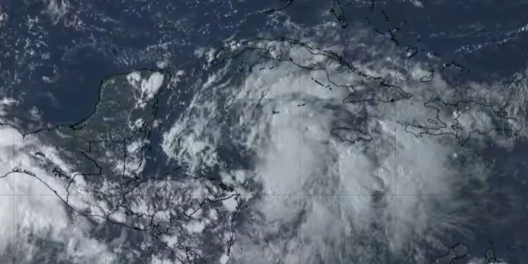
SAN LUIS POTOSÍ, Mexico.- The meteorologist Yinelys Bermúdez warned on Monday night that the wide area of low pressure located over the western Caribbean Sea will gain intensity and the rains could be strong and intense.
According to the official newscast of the Caribbean Channelthe area is generating abundant cloudiness but with disorganized showers, rain and thunderstorm activity due to the fact that the system is currently passing through an area where strong winds in the upper layers of the atmosphere prevent better organization of its cloud pattern.
However, in the next 12 to 24 hours the phenomenon will move north-northwest, and the areas of showersrain and thunderstorms over Cuban territory.
In the western and central regions, rains could be strong and intense in some localities, starting this Tuesday afternoon.
According to the specialist, as the system moves northwest over the western Caribbean Sea, conditions will be more favorable for better development and organization, which would lead to a depression or tropical storm within 12 to 24 hours.
The Cuban meteorologist also warned that the intensity and trajectory of the meteorological event will depend on the intensity of the wind, the height of the waves and the possible storm surges and coastal flooding on the southern coast of the western region.
“At this time, we can see how the cloud cover is increasing in much of the country and the mobility of showers and thunderstorms in some localities, especially in the central and eastern regions,” said the specialist.
Showers, rain and thunderstorms are forecast for Tuesday in the western region from late morning. “In the afternoon, cloud cover will increase over much of Cuba, with a high probability of showers, rain and thunderstorms in the west and center. The rains during the afternoon and night will be strong and intense in localities in the western region and there will be some showers and rain in inland areas and south of the eastern region.”
According to the INSMET Forecast Center’s report on Monday, the area “has become better organized in the last 12 hours,” which could lead to the formation of a depression or tropical storm “in the coming days.”


