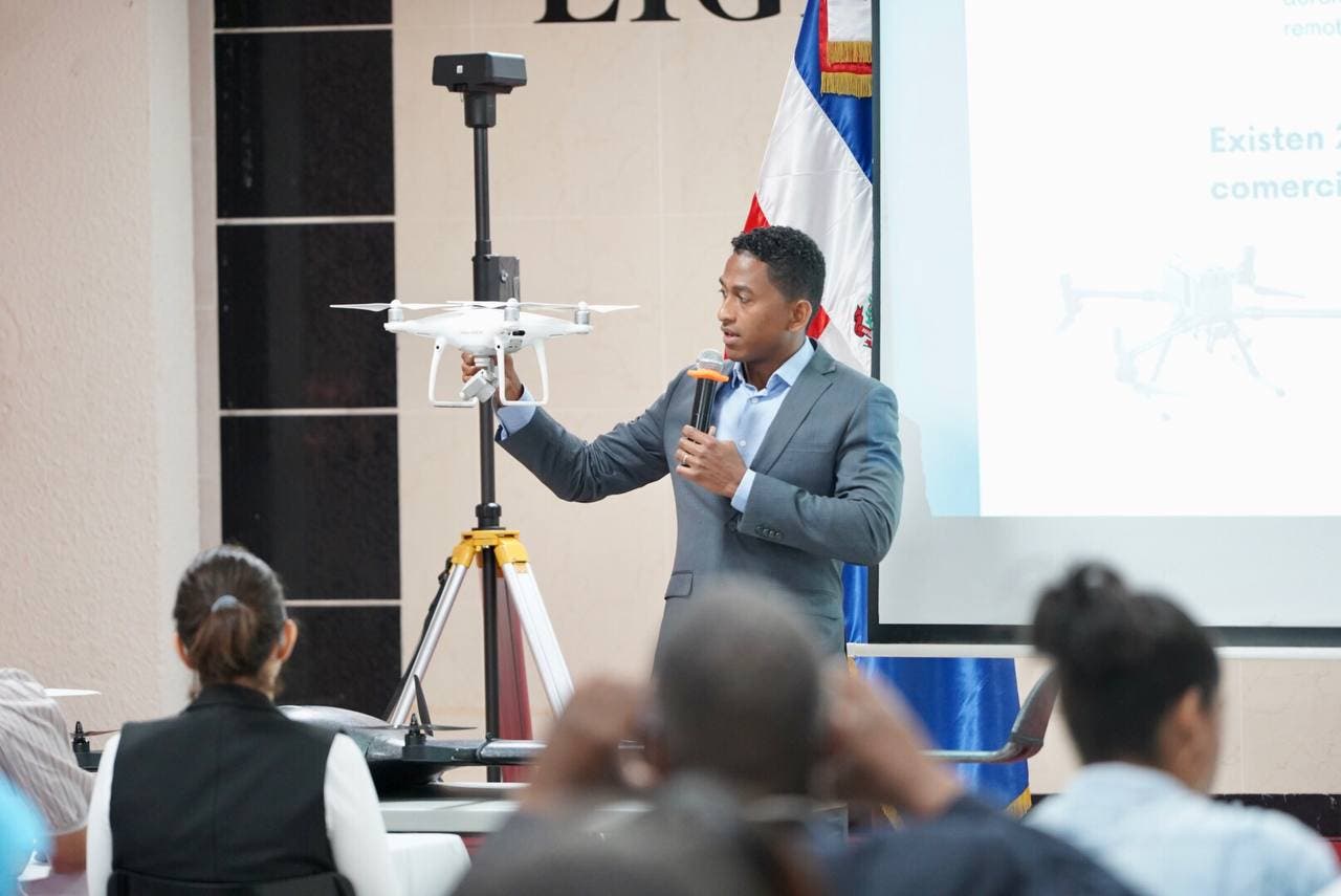
Santo Domingo.- The Dominican Municipal League (LMD), in coordination with the Ministry of Public Works (MOPC) and the National Geographic Institute, gave the workshop “Drones and Geographic Information Systems in the Creation and Maintenance of the Municipal Cadastre and Land Management Plans”.
The training was aimed at those in charge of the Urban Planning departments of the different municipalities of the country with the purpose of promoting the use of new technologies that allow them to locate, describe and register indicators in the territorial ordering of the municipalities.
For the Municipal League it is of great interest to train those in charge of Urban Planning in the use of drone technology, due to the impact it can generate in the efficiency of the processes of surveying and managing information from the territories.
The course was divided into three modules that addressed issues related to obtaining drone images and their interpretation, the territorial ordering of municipalities and municipal districts, as well as the use of drones in the management of the municipal cadastre, with the purpose of that local governments can analyze these topics in the zones.
The use of drone technology will allow forecasts to be made for the execution of public policies in each of the territories. These devices can also be used for the evaluation of infrastructures such as the construction of sidewalks and embankments, allowing the works to be carried out more quickly and with a wide margin of reduction of economic resources.
During the training, the topic of the use of the public administration of the cadastre was developed, which allows detecting the characteristics of the real estate located in the different territories, knowing who the owners of said goods are and registering their legal-economic situation.
The training also addressed Geographic Information Systems (GIS), which have now become essential elements in the visualization and planning activities of territories in the environmental, social and economic fields.
The exhibitors explained that these tools, as well as the creation and management of maps in open source software, allow the staff of the Urban Planning departments of the municipalities to have a broader knowledge of the realities experienced by the citizens in each sector.
The modules were in charge of the directors of Topography and Castro, of the Municipal League, Rubén Hiciano; of special cases, Edward Acosta, and of Urban Planning, George Richardson. For Public Works, Alberto Canahuate and Loifredo Núñez participated for the National Geographic Institute. The words of welcome were given by Valentín Santos, Undersecretary of Public Works Planning.
