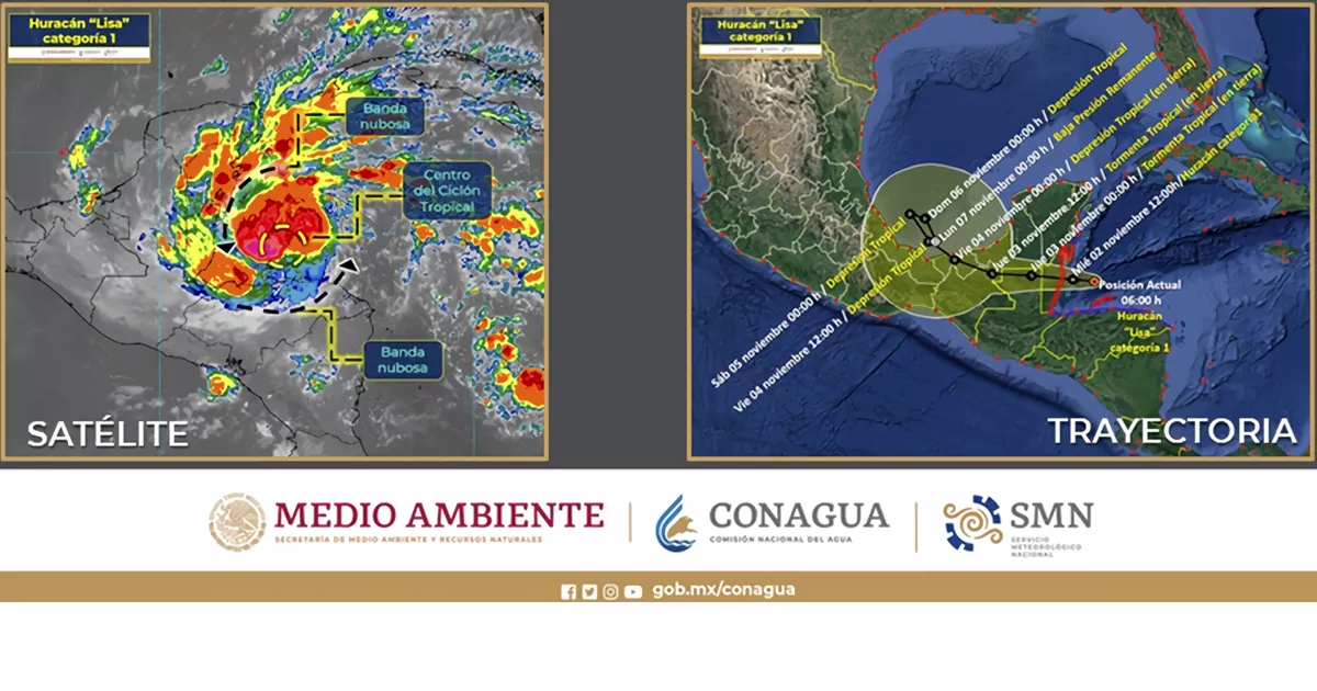
The SMN explained that at 9:00 p.m. on Tuesday, the tropical storm “Lisa” It was located approximately 210 kilometers east-northeast of Roatán Island, Honduras, and 382 km east-southeast of Puerto Costa Maya, Quintana Roo, with maximum sustained winds of 110 kilometers per hour (km/h), gusts of 140 km/h and traveling west at 24 km/h.
“Its cloud bands will generate very heavy rains in parts of Quintana Roo, showers in Campeche and Yucatan, as well as gusts of wind of 40 to 50 km/h and waves of 1 to 2 meters high on the coasts of Quintana Roo”, detailed the agency in a statement.
The SMN, in coordination with the National Hurricane Center in Miami, United States of America, activates the prevention zone for hurricane effects from Chetumal to Puerto Costa Maya in Quintana Roo, and extends the prevention zone for tropical storm effects from Puerto Costa Maya to Punta Allen, in the same entity.


