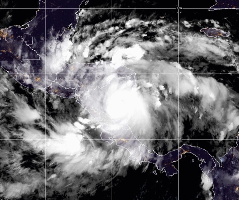
It is forecast that Julia It will remain as a tropical storm as it crosses Nicaragua today and reaches the adjacent waters of the Pacific tonight, reported the United States National Hurricane Center (NHC) on the morning of this Sunday, October 9.
“Tropical storm warnings are in effect along the Pacific coasts of Nicaragua, Honduras, and El Salvador to take into account the likelihood of tropical-force winds in those areas later today through Monday,” the recently published report indicates. at 9:00, Nicaragua time..
It adds that tropical-force winds are also possible Monday along Guatemala’s Pacific coast, where a tropical storm watch is in effect.
Related notice: Hurricane Julia causes significant damage upon impact in Nicaragua
“Flash flooding and life-threatening landslides are expected in parts of Central America on Sunday and Monday. Flash flooding is anticipated in Mexico’s Isthmus of Tehuantepec early this week,” the NHC warns.
Likewise, the Nicaraguan Institute of Territorial Studies (Ineter) reported that the tropical storm has maximum sustained winds of 110 km/h (decreased by 10 km/h), with a travel speed of 24 km/h (decreased by 2 km/h ) heading west; It advances over national territory and currently its center is located approximately 105 km northeast of Managua.
Julia It presents a trajectory through Camoapa, Teustepe, Tipitapa, San Francisco Libre, León, and exiting to the Pacific Ocean through Corinto.
“As each of these places, including the capital city Managua, is approached, the residents will feel an increase in the winds and an increase in the intensity of the rains, so it is recommended to take the pertinent precautions,” indicates the report.
“Upon leaving the waters of the Pacific Ocean, probably in the first half of Sunday night, Julia it could strengthen again, as it moves away from our territory. The increase in these winds and the effect of their circulation will transport moisture from the Pacific Ocean to the interior of the country, generating more rains in the Pacific region, mainly.


