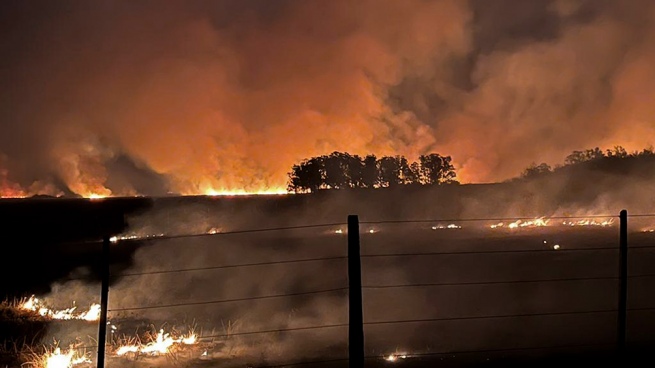
Rural fires destroyed more than 785 thousand hectares in Corrientes, which constitutes 9% of the provincial surface, reported the National Institute of Agricultural Technology (INTA), and noted that the fire reaches 30 thousand hectares per day.
The latest technical report from INTA’s Corrientes Experimental Station on the evolution of burned areas indicated that the area burned as of February 16, 2022, amounted to 785,238 hectares.
The study also determined that “the rate of fire progression between February 7 and 16 was almost 30 thousand hectares per day.”
“In absolute values, the vegetation cover most affected are the estuaries (and other wetlands) where the area doubled, going from 124 thousand hectares to more than 245 thousand”, indicates the study carried out by the technicians: Griselda Saucedo, Ruth Perucca and Ditmar Kurtz.
And he added that “cultivated forests were also very affected, since the burned area increased almost two and a half times, going from 12,000 to more than 31,000 hectares.”

In this way, the report highlighted that the satellite evidence indicates that the fires consumed 408,846 thousand hectares of weeds, estuaries and other wetlands; 31,265 hectares of cultivated forests and more than 28 thousand of native forests.
In addition, he detailed the number of hectares burned in each of the departments of the province, the most affected by the fire being Ituzaingó, with 138,100; San Miguel, with 93,713 and Santo Tomé with 81,705 hectares.
“In general, the rate of increase in the area affected by burning exceeded the trend calculated in the previous report, going from a trend of 20,000 hectares per day to about 30,000 in recent days,” the INTA report concluded.


