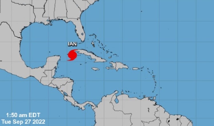
MADRID, Spain.- Hurricane Ian reached category 3 in the early hours of this Tuesday, very close to making landfall in western Cuba.
According to reported According to the National Hurricane Center of the United States (NCH, for its acronym in English), Ian moves with winds of 185 kilometers per hour and was located 50 miles (80 km) from the province of Pinar del Río.
The NHC indicated that a rapid strengthening is expected this Tuesday and warned of “significant impacts of wind and storm surge” in this region of the Island.
2:30 AM EDT 9/27 Update: Hurricane #Ian strengthens into a major hurricane. A tropical cyclone update has been issued. More: https://t.co/tW4KeFW0gB pic.twitter.com/clUcNw5cBF
— National Hurricane Center (@NHC_Atlantic) September 27, 2022
The Cuban provinces of Pinar del Río and Artemisa and the special municipality of Isla de la Juventud are under a hurricane alert.
According to forecasts from the National Hurricane Center, Ian will make a turn to the north-northeast and touch western Cuba on Tuesday morning. It should then continue over the southeastern Gulf of Mexico, and west of the Florida Keys, on Thursday.
Specialists point out that the hurricane will reach category 4 on the Saffir-Simpson scale, out of a total of 5.
Already this Monday strong swells were affecting Pinar del Río and the south of the Isla de la Juventud, with waves between five and seven meters high; as well as coastal flooding, which also affected the southern coast of Artemisa and Mayabeque.
This Monday the Cuban authorities reported that the public transport service would be gradually suspended in Havana in order to avoid traffic accidents.
Interprovincial transport was also suspended in the West of the country.
Receive information from CubaNet on your cell phone through WhatsApp. Send us a message with the word “CUBA” on the phone +525545038831, You can also subscribe to our electronic newsletter by giving click here.
