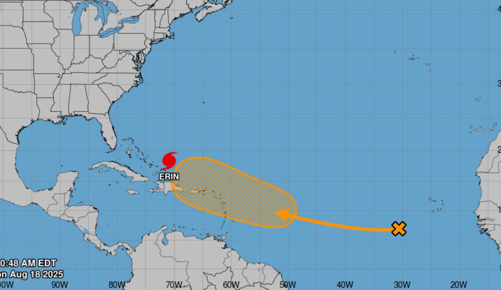
With category 4 on the Saffir-Simpson scale, Hurricane Erin advances northwest with maximum sustained winds of 215 kilometers per hour (km/h) while another event could have development in the Atlantic the next few days.
The first hurricane of the current cyclonic season was located near latitude 23.1 northern, length 70.5 west and circulates at 20 km/Hy could have a gradual turn to the north late today and Tuesday, on Tuesday, They point means like Latin press (PL).
Aug 18 1115 am edt: Update on Major Hurricane #Erin From National Hurricane Center Director Michael Brennan Visit https://t.co/tw4KegdBB For the Latest Forecast https://t.co/gfyzi2cfbw
– National Hurricane Center (@NHC_Atlantic) August 18, 2025
The National Hurricanes Center (NHC), meanwhile, highlights that in its possible career, Erin’s core passes east of the southeast of the Bahamas on this day and moves between the Bermuda and the east coast of the United States in the mid -week.
The maximum sustained winds have increased to about 220 km/h with higher bursts while their winds with a force of hurricane extend out to 130 km from the center and the winds with a tropical storm force extend out to 370 km.
After intensifying quickly, Hurricane Erin advances in the Atlantic but far from Cuba
The NHC also warns that a tropical wave located on the Eastern Tropical Atlantic is producing disorganized rains and thunderstorms.
Environmental conditions seem conducive to the gradual development of this system, and a tropical depression could be formed for weekends.


