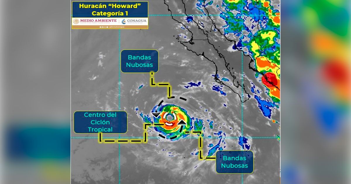
The hurricane, which is the eighth of the Pacific season, maintains maximum sustained winds of 130 kilometers per hour, gusts of 155 kilometers per hour and is moving northwest at 20 kilometers per hour.
Due to its trajectory, the system will move away from Tuesday. Likewise, the SMN warned of showers of 5 to 25 millimeters in Baja California Sur.
There will also be gusts of wind of 50 to 60 kilometers per hour and waves of 1 to 2 meters in height in said Mexican state.
Maritime navigation in the vicinity of the system is urged to take extreme precautions due to conditions of strong winds and high waves”, specified the SMN .
Previously, the SMN, of the National Water Commission, warns that the predicted rains could generate landslides, increased levels of rivers and streams, overflows and floods in low areas.
The body dependent on the National Water Commission also forecasts winds with gusts of 60 to 70 kilometers per hour (km/h) on the Isthmus and coasts of the Gulf of Tehuantepec; as well as gusts of 50 to 60 km/h in Aguascalientes, Chihuahua, Coahuila, Durango, Nuevo León, Puebla, San Luis Potosí, Sinaloa, Sonora, Tamaulipas, Zacatecas and the coasts of Campeche and Yucatán.
Hurricane Howard track live
It is possible to follow the location of Hurricane Howard live with the help of this real-time map:


