October 6, 2024, 1:30 PM
October 6, 2024, 1:30 PM
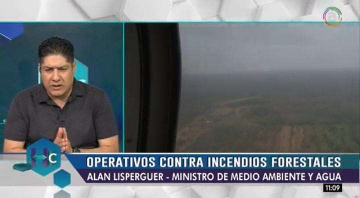
The Minister of Environment and Water, Alan Lisperguer, indicated that The effects of forest fires have registered 4.6 million hectares in forested areas and 2.3 million would correspond to grasslands. This leaves a total of 6.9 million hectares.
“Before, when the measurement was made, we had a larger area (affected) of grasslands and this was because many producers began to burn, but now they have ended, mainly in Santa Cruz, and now “This lack of control is seen on surfaces that affect forested areas.”explained the minister in an interview with state officials.
In turn, he referred to the information circulating on social networks on the surfaces affected by forest fires, indicating that it is not correct and added that the only instance to provide official information on affected areas, according to DS 2912, is the Forest Information and Monitoring System (SIMB), which It depends on your ministry.
“I refer to this topic because We have been observing that some NGOs, but mainly (Fundación) Tierra is an entity that generates information that is not official and therefore confuses the population,” said Lisperguer.
The head of Environment and Water added that this is not valid information for them because They are unaware of the mechanisms used by these NGOs to calculate the affected areas, for example.
He added that the information that the SIMB generates It does this thanks to the satellites it has.
“We do not know if this foundation has access to this type of information and on the other hand We also do not believe that they can do ground verification. Therefore, we state that this information is not responsible and is used for political purposes,” he said.
On the other hand, Minister Lisperguer pointed out that international organizations, from France, Germany and Spain They highlighted the work they have been doing the Fire Monitoring Center located in the department of Santa Cruz.
“It is a Monitoring Center that is really well recognized, also, for the cooperation of the specialists who have arrived from other countries, both Germany, Spain and France, who “They have been able to recognize that the information generated is very precise,” stated Lisperguer.
He added that the information generated “serves day by day” for decision making in operational planning, both for aerial discharges, ground suffocation work, but It also helps us forecast and develop climate scenarios. to be able to implement other actions.
In this center, he added, the forest monitoring system is used that also uses satellite information, including from the European Union and NASA.


