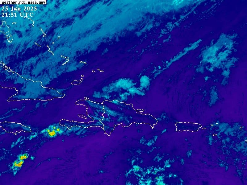
He Friito of recent weeks is due to the incidence of a weak trough In the Dominican territory it will continue to cause scattered downpours With possible thunders this afternoon, the National Institute of Meteorology (Indomet).
In your report it details that the rains They will be more intense especially towards the southeast, northeast regions, the central mountain range and some provinces of the Southwest.
However, he explains that temperatures will be slightly hot, during the day, while the night and early in pleasant to freshdue to the time of the year, especially in mountains and valley of the interior of the country.
Provides that in the National District There will be dispersed clouds partly cloudy sometimes, in Santo Domingo Norte A situation will be presented and them in Santo Domingo Este and Santo Domingo Oeste.
Alert that due to the Vaguada At the low levels of the troposphere, it recommends that the fragile vessels do not navigate in the sea due to dangerous winds and waves.
For Monday, Indomets predicted that the effects of the phenomenon together for the effects of the east wind will be favoring the cloudy For passenger rains with bursts of wind, especially during the afternoon, over provinces of the Southeast, Northeast and the Central Cordillera.
You can read: They forecast downpours and bursts of wind in several provinces
COE
The Directorate of the Emergency Operations Center (COE), reports that, according to the weather newsletter of today, of the Dominican Institute of Meteorology. ”INDOMET”, Which establishes that the surf It is progressively deteriorating on the coast of the country, due to strong winds, this condition will last approximately 48 to 72 hours.
On the Atlantic coast, he re comings from Cabo San Rafael (La Altagracia) to Cabo Cabrón (Samaná), navigate with caution.


