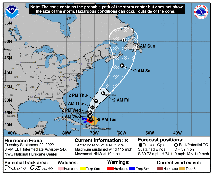
The hurricane Fiona increased to category three and now its maximum winds are 185 kilometers per hour with higher gusts, according to the 5:00 a.m. bulletin on Tuesday from National Hurricane Center from the United States.
At 5:00 am this Tuesday the center of Fiona It was located near latitude 21.5 north and longitude 71.0 west, about 30 kilometers southeast of Grand Turk Island, it is moving north/northwest at about 17 kilometers per hour and will continue to move away from the Dominican Republic.
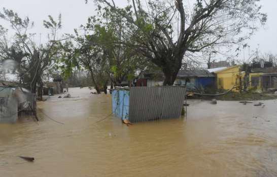
According to the bulletin, the outer bands of Fiona will continue to produce heavy rains over primarily coastal and eastern sections of the Dominican Republic and local portions of southern Puerto Rico during the next 24 hours as Fiona it moves from north to northwest over the southwestern Atlantic Ocean.
“Swells generated by Fiona They are affecting the Virgin Islands, Puerto Rico, the north coast of Hispaniola, the Turks and Caicos Islands, and the southeastern Bahamas. National Hurricane Center while noting that the conditions of hurricane are spreading over the Turks and Caicos Islands with tropical storm conditions expected in parts of the southeastern Bahamas beginning in the next few hours.
The institution predicted that in the Dominican Republic Fiona will produce an additional 1 to 4 inches with a local maximum of 6 inches of rain over the next 24 hours. In Turks and Caicos Islands an additional 4 to 8 inches.
Rains will continue in the country
The National Meteorological Office (Onamet) reported in its Tuesday morning bulletin that the weather conditions in the Dominican territory will continue to be dominated by a broad and compact cloud field associated with the hurricane Fiona that covers the entire country.
He predicted that for the next 24 to 36 hours moderate to heavy rains will continue to occur, becoming intense at times, electrical storms and occasional gusts of wind.

These rains will occur especially over La Altagracia, El Seibo, La Romana, Hato Mayor, San Pedro de Macorís, Monte Plata, Samaná, Sánchez Ramírez, María Trinidad Sánchez, Duarte, Espaillat, La Vega, Villa Altagracia, Monseñor Nouel, the Great Saint Domingo, San Cristóbal, Peravia and Santiago, among other provinces.
“The waves will continue to be abnormal on the north coast, northeast and points in the southeast. Waves are expected to range from 10 to 14 feet in height with top breakers reaching up to 18 feet. It is recommended to be very attentive to the possibility of coastal penetrations in low-lying areas, ”he indicated.
Trajectory
Fiona is moving toward the north-northwest near 17 mph, the motion is expected to continue through today, followed by a turn toward the north tonight or Wednesday.
On the forecast track, the center of Fiona will continue to move near the Turks and Caicos Islands over the next several hours.
Hurricane-force winds extend about 45 kilometers outside its center and storm-force winds about 240 kilometers.


