The formation of a new extratropical cyclone in the southern region of the country is intensifying in Santa Catarina, with the arrival of isolated storms, with lightning, gusts of wind, hail and occasional flooding in the southern coastal regions and in greater Florianópolis. A meteorological alert, released by the state’s Civil Defense, predicts that the storm will last between two and three hours.
In a note published last Friday (30), Santa Catarina’s Civil Defense warned of the formation of an extratropical cyclone, expected to arrive between Monday (2) and Wednesday (4).
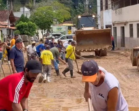
“The phenomenon should form close to the Southeast Region and bring more rain to the coast of Santa Catarina. From the early hours of Tuesday (3), the storms tend to gain intensity, mainly between the north coast and greater Florianópolis. The high accumulations increase the risk of flooding, flash floods and possible landslides.”
THE meteorologist Nicolle Reis, from Civil Defense, said that “unlike the weekend, when instabilities are temporary, the rain should occur persistently and voluminously in the coming days”.
Civil Defense also reported that from this afternoon until tonight, the heating, humidity and influence of an area of low pressure and more intense winds at different levels of the atmosphere, once again favor the formation of isolated storms. “Although the unstable weather is restricted to the easternmost areas of the state, such as the coast and Vale do Itajaí, and the storms are more isolated than the previous day, they can still produce hail and intense gusts of wind in a localized manner.”