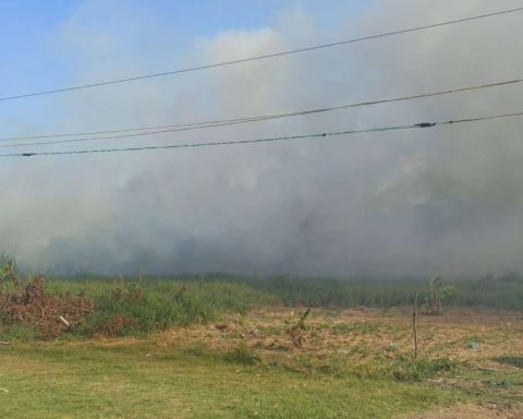
The European Union (EU) in Chile reported that the Copernicus Emergency Management Service has been activated, for the production of satellite maps in “quick mapping” mode, in order to support the authorities with the emergency response to the fires. forestry in the center-south zone of the country.
“Copernicus” is an EU program aimed at developing information services based on satellite Earth observation and in situ (non-space) data. The system is implemented by the European Commission (EC), with the support of the European Space Agency (ESA) for the space component and the European Environment Agency (EEA) for the in situ component.
“The objective of Copernicus is to monitor and forecast the state of the environment on land, sea and atmosphere, to support climate change mitigation and adaptation strategies, efficient management of emergency situations and improved security of all citizens”, details its website.
Josep Borrell, the high representative of the Union for Foreign Affairs and Security Policy and vice president of the European Commission in the community executive of Ursula von der Leyen, recounted on Twitter that he spoke with Chancellor Antonia Urrejola, to express his solidarity in the face of the devastating fires that ravage Chile. “The EU is helping and has activated the #EUCivilProtectionMechanism. All our support to the people of Chile,” he commented.
For her part, the head of the Ministry of Foreign Affairs, Minister Antonia Urrejola, thanked the solidarity of the EU, “for accompanying us in these difficult times.”
“Thanks to the EU for the collaboration. As President Gabriel Boric says, solidarity transcends borders,” added the Chilean chancellor.
It is worth mentioning that, in addition, thirteen countries of the European Union (EU) offered search and rescue teams on Monday, in the face of the catastrophe registered in the Ñuble, Biobío and La Araucanía regions, according to the European Commission.
The ?? has activated the Emergency Management Service of @CopernicusEU for the production of satellite maps in rapid mapping mode, in order to support authorities with the emergency response to forest fires in ??.
Check them ?https://t.co/q8NuyuwtF8 pic.twitter.com/DvkPu9h6bb— EU in Chile ?? (@UEenChile) February 6, 2023


