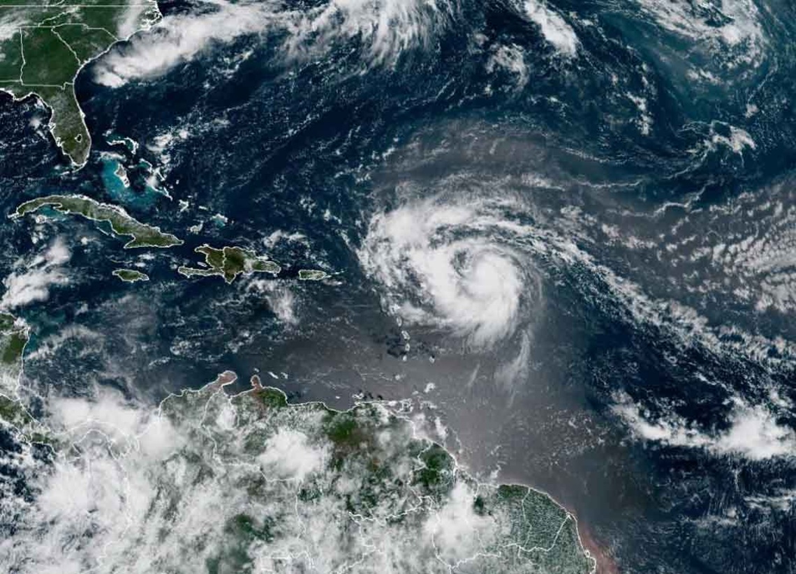
The tropical storm Erin was strengthened in the last hours and became this Friday the The first hurricane of the 2025 Atlantic seasonas reported by the National Hurricanes Center (NHC) of the United Statescited by the agency EFE.
The phenomenon threatens torrential rains, dangerous swells and flood risk in the Sotavento Islands of the North, the Virgin and Puerto Rico Islands during the weekend.
According to the data disseminated by the NHC and collected by EFEat 11:00 am local time (15:00 GMT) Erin’s eye was close to the 18.2 ° north and length 56.1 ° west, about 740 kilometers east of the islands of Sotavento del Norte. The cyclone has maximum sustained winds of 120 km/h, with stronger bursts, and moves to the west-northwest at 30 km/h, with a minimum central pressure estimated at 996 millibar.
The NHC keeps a Tropical storm surveillance for Anguilla and Barbuda, San Martín, San Bartolomé, Saba, San Eustaquio and Sint Maarten. This implies that tropical storm conditions are possible in those areas within 48 hours, as the system approaches on Saturday.
Meteorologists expect Erin to maintain a west-northwest trajectory during the weekend, passing near or just north of the Northern Sotavento Islands. According to the projections cited by EFEthe hurricane could be quickly intensified and reach major category on the Saffir-Simpson (3 or more) scale in the next two or three days.
NOAA hunting aircraft and the United States Air Force detected that winds with force of hurricane They extend up to 35 kilometers From the center, while those of tropical storm reach 185 kilometers, mainly north.
Hurricane #Erin Advisory 17: Erin Becomes The First Hurricane of the 2025 Season. EXPECTED TO PASS NEAR OR NORTH OF THE LEEWARD ISLANDS ON SATURDAY. https://t.co/tw4KegdBB
– National Hurricane Center (@NHC_Atlantic) August 15, 2025
The NHC warns that Erin’s external bands will produce Rain accumulations between 50 and 100 millimeterswith isolated maximums of 150 millimeters, from tonight to Sunday in the islands of Sotavento del Norte, the Virgin Islands and Puerto Rico. These rainfall could cause sudden floods, landslides and river floods.
Dangerous swells and currents are also expected that will affect much of the region and that could spread towards the Western Atlantic next week.
Erin is The fifth system with the name of the Atlantic season of 2025after Andrea, Barry, Chantal and Dexter. Chantal was the first to play land in the United States this year, leaving at least two dead in North Carolina in July.
The Oceanic and Atmospheric National Administration (NOAA) maintains its prognosis of a “superior to normal” cyclonic season, with between 13 and 18 tropical storms, of which between five and nine could become hurricanes and up to five reaching major category between August and November.
Meanwhile, the NHC and the local authorities recommend the population of the areas under surveillance to remain informed and prepare emergency plans to a possible impact.


