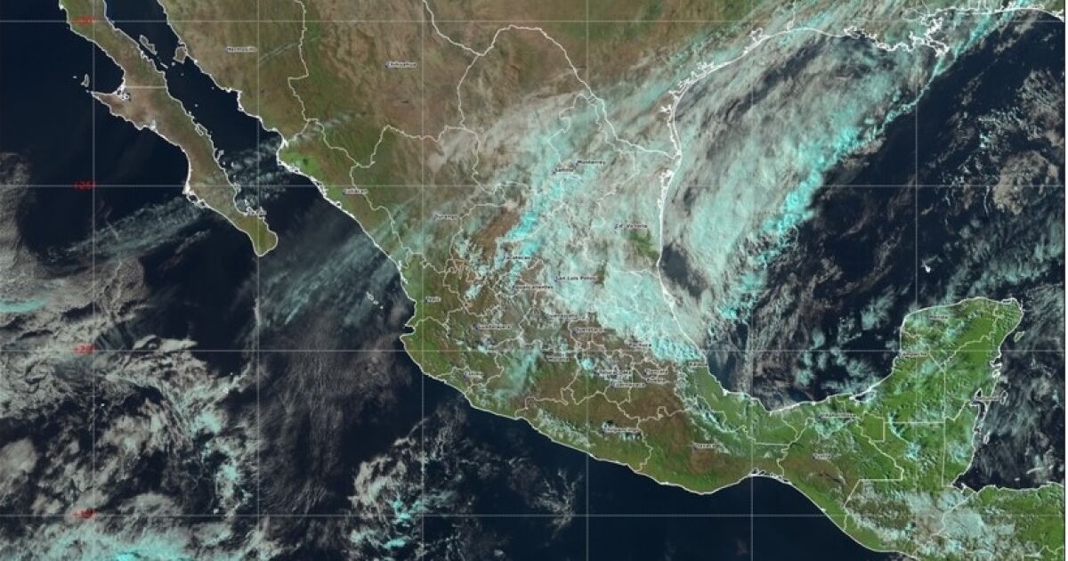
The meteorological phenomena will cause the most intense rains, known as torrential rains, in the regions of Veracruz, Oaxaca, Chiapas and Tabasco. In these states, rainfall of between 150 and 250 millimeters (mm) is expected.
Very strong and intense rains are also expected in Veracruz, with 75 to 150 mm, especially in the areas of Papaloapan and Los Tuxtlas.
In the Tehuacán-Sierra Negra region of Puebla and in the Mountains of Veracruz and Campeche, there will be heavy to very heavy rains (50 to 75 mm).
According to the weather forecast of the National Meteorological System (SMN), showers with occasional heavy rains (25 to 50 mm) are also expected in the Serdán Valley, Puebla, as well as in Nautla, Capital and Sotavento, in the state of Veracruz.
“Because this rainfall can generate flooding, the population is recommended to avoid crossing water currents and stay away from low areas that may flood,” Civil Protection reported.
He warned that, in addition, a “North” event will cause strong winds along the entire coast of the Gulf of Mexico, the Isthmus and Gulf of Tehuantepec, for which he asked the population to “secure objects that may be projected and take extreme precautions in maritime navigation.”
This Saturday, the #ColdFront 27 ❄️ over the Gulf of Mexico will cause #Rains of different intensities:
⛈️ Intense (from 75 to 150 mm): in Tabasco, the north and east of Oaxaca, northwest and north of Chiapas, Sierra Nororiental and Valle Serdán regions of Puebla, and Nautla, Capital and… pic.twitter.com/2puvQBSB8G
— National Civil Protection Coordination (@CNPC_MX)
January 10, 2026
In turn, the National Water Commission (Conagua) detailed that cold front 27 will move towards the Yucatán Peninsula and the southeast of the country. Until six in the afternoon this Saturday it was over the Gulf of Mexico.
He warned that heavy rains are also expected in Chihuahua, Durango, Sinaloa and Quintana Roo; showers in Nayarit, Coahuila, Nuevo León, Tamaulipas, San Luis Potosí, Zacatecas, Yucatán and Hidalgo.
As well as isolated rains in Sonora, Aguascalientes, Jalisco, Michoacán, Guanajuato, Querétaro, Tlaxcala, State of Mexico, Mexico City, Morelos and Guerrero.
“The predicted rains could generate landslides, flooding, flooding and overflowing of rivers or streams, so the population is urged to heed the warnings of the National Meteorological Service (SMN), the National Water Commission (Conagua), and follow the recommendations of Civil Protection,” he warned.
The “North” event will remain until Monday with strong gusts of wind that, equal to or greater than 50 kilometers per hour, he explained, could knock down trees and advertisements.
There will also be high waves in different states of the country.
Cold alerts activated in CDMX
The government of Mexico City activated the orange alert due to the forecast of low temperatures during the early morning and morning of this Sunday, January 11.
The alert applies to the Magdalena Contreras, Milpa Alta and Tlalpan municipalities.
While the yellow alert due to cold was activated for Álvaro Obregón, Cuajimalpa, Tláhuac and Xochimilco.


