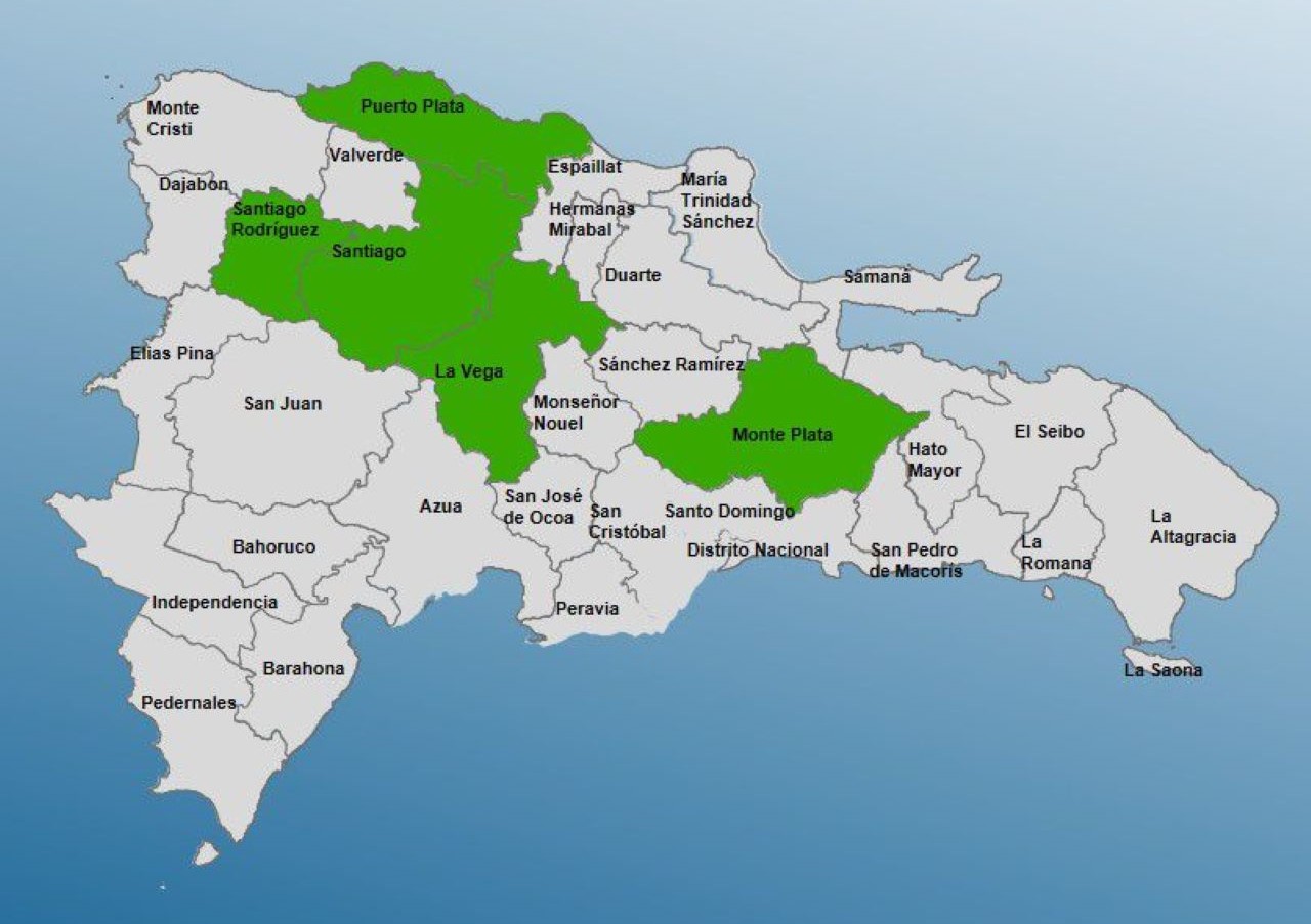
Santo Domingo.- The Center of Operations of Emergencies (COE) increased this Friday to five provinces on alert green before the approach of a trough associated with a prefrontal.
The locations under alert are Santiago, La Vega and Puerto Plata, Mount Plata and
Santiago Rodríguez
The emergency agency indicated that, since early hours, moderate rains have been generated, which would be causing increases in cloudiness, moderate to heavy downpours at times, possible electrical storms and gusts of wind.
In this sense, the population is recommended to refrain from crossing rivers, streams and ravines that have high volumes of water, and not to use spas in the indicated areas.
The Meteorological entity released this information through the bulletin issued by the Dominican Institute of Meteorology (INDOMET).
Cloudy fields and sporadic rain will continue on Saturday
He INDOMET He indicated that tomorrow, Saturday, the rains will decrease, as a result of the weakening of the pre-frontal trough in the northeast of the country.
However, the increase in the speed of the easterly wind and the passage of a trough in the middle and lower levels of the troposphere will favor isolated showers and occasional gusts of wind during the afternoon and early evening, mainly in María Trinidad Sánchez, Duarte, Sánchez Ramírez, Monseñor Nouel, Samaná, San Pedro de Macorís, Hato Mayor, El Seibo, Santo Domingo and La Altagracia.
Forecast by demarcations
National District: cloudy with scattered rain, distant thunderstorms and occasional gusts of wind.
Santo Domingo North: cloudy with scattered rain and isolated thunderstorms.
Santo Domingo East: cloudy with scattered rain, distant thunderstorms and gusts of wind.
Santo Domingo West: cloudy with scattered rains, isolated thunderstorms and gusts of wind at times.
