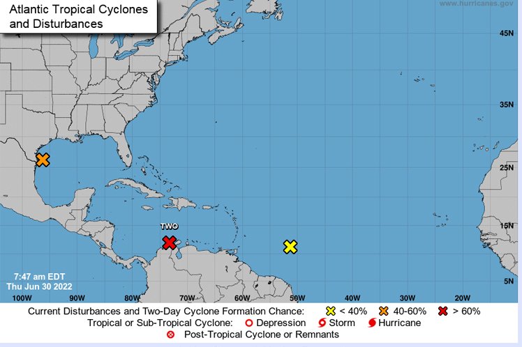
a potential cyclone tropical moved this Thursday in the direction of the Caribbean coast of Nicaragua and Costa Rica, in Central America, where it could hit from Friday with rains, winds and floods. Precisely, the Colombian Caribbean remains on alert for the tropical cyclone that is heading towards the west and has a speed of around 31 k/h.
It is expected that during the passage of this tropical phenomenon through San Andres and Providence the waves can reach between three and five meters, in the same way, the winds will be too strong, For this reason, it is recommended to seek a safe refuge and follow the recommendations of the local authorities.
You may be interested in: Government ordered permanent monitoring of San Andrés and Providencia due to tropical storm
The Ideam commented through a statement: “SIt remains as Potential Tropical Cyclone Two with a 90% probability of tropical storm formation during the next 36 hours.s, moving west at a speed of approximately 31 km/h, with maximum sustained winds of 65 km/h”.
How long is it expected to last?
The entity also clarified, “the probability to date is that the system evolves to the category of tropical storm, favoring heavy rainfall, increased waves and wind in the area of the archipelago of San Andrés, Providencia, Santa Catalina and the keys, between today Thursday and tomorrow Friday“.
The tail blows of the cyclone can be felt from the early hours of Friday, July 1 through Saturdaysince, during this day, the distance between San Andrés and Providencia and Potential Tropical Cyclone Two is between 143 kilometers and 286 km.


