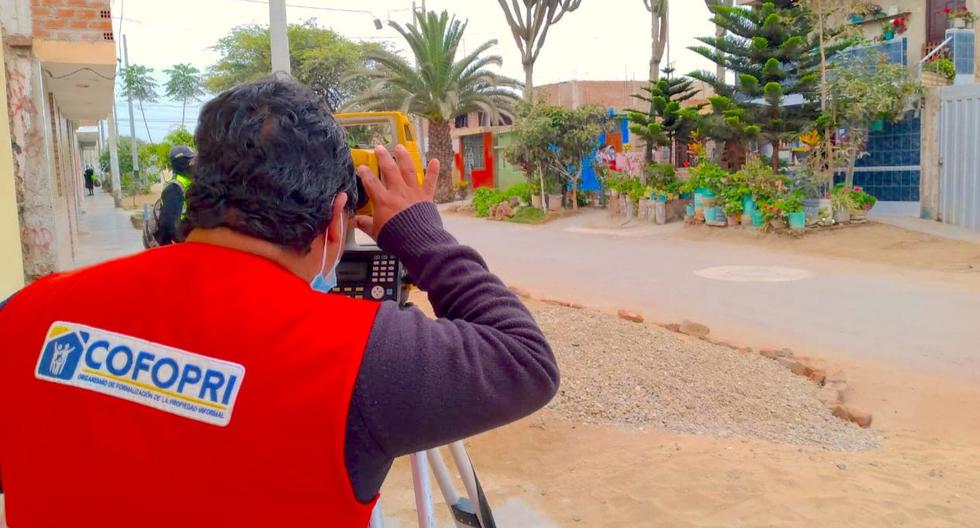
In order to contribute to the social and economic development of the inhabitants of the Moche district in the province of Trujillo, La Libertad region, the Informal Property Formalization Agency (Cofopri) is conducting for the first time the Urban Cadastre, which consists of the physical inventory of real estate.
“With the urban cadastre that Cofopri executes, more than 37,400 residents will benefit, since the information will contribute to the orderly growth of the district, the planning of infrastructure works, the development of the real estate market and the promotion of public and private investments.s ”, explained the head of the Zonal Office in the La Libertad Region, José Miguel Zelada Alfaro.
For this, a general territorial diagnosis known as “characterization”, in which the district has been divided into 11 sectors, identifying 734 blocks and 11 thousand 616 lots.
For his part, the mayor of the District Municipality of Moche, César Arturo Fernández Bazán, stressed that the strategic information that is being collected will allow to promote modern municipal management thanks to the detailed inventory of all real estate assets to develop infrastructure plans, citizen security , tourism, among others.
“I invoke the neighbors so that they can support the brigades of the urban cadastre of Cofopri and provide all the facilities of access and data collection for the development of our district”, He indicated.
The information registration tasks in the field include registration activities, physical verification and taking photographic samples by cadastral technicians and supervisors.
First results
It has been identified that the district of Moche has 10,529 homes, 1093 lots for businesses, 33 educational centers, 8 health centers, 31 religious entities, an industrial lot, as well as 2321 unbuilt land and 112 under construction. It has also been identified that 317 are being used in various uses.
Currently the Urban Cadastre Project is in the final stage with actions of registration, cartographic verification and taking photographic samples in the field by the cadastral technicians; and in parallel, the verification and editing of plans of the urban component (benches, signs, electric lighting poles, street signs, etc.) has been carried out.
Finally, it is important to note that once this stage is finished, the final plans of the sectors where the Urban Cadastre is carried out will be drawn up, and after the corresponding validation the data will be delivered to the district municipality.
