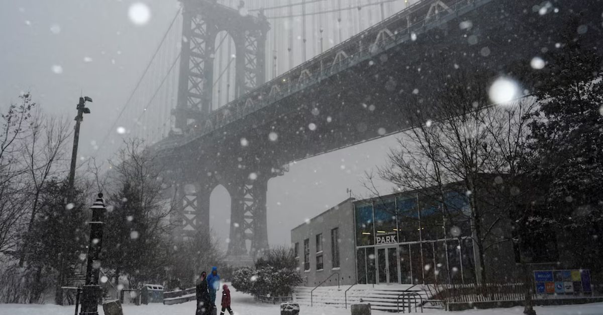
New York City is experiencing its most intense and prolonged period of extreme cold in nearly ten years, according to official data from the National Weather Service (NWS) and reports from Newsweek.
This began on Friday, February 6, 2026and is affecting millions of residents in the northeastern United States. Persistent sub-zero temperatures pose risks to public health and the operation of essential servicesaccording to warnings from city and state authorities.
The National Weather Service (NWS) reported that high temperatures in New York City are hovering around -6°C (23°F), with nighttime lows dropping to -13°C (13°F), accompanied by wind chills that could make it feel as cold as -20°C (-4°F).
NWS meteorologist David Stark told Newsweek that “it’s been eight to ten years since we’ve seen such a prolonged cold snap” in the city, adding that this cold snap represents the most severe episode of the current winter. Authorities are urging residents to take precautions and stay informed about the evolving situation.
The NWS historical record shows that the northeastern United States has experienced harsh winters, but the duration and intensity of the current storm are unprecedented since 2016. Emergency management agencies have implemented protocols to mitigate infrastructure impacts, while real-time weather monitoring continues through official channels and specialized media.
Why is this cold wave in New York the worst in almost a decade?
The current extreme cold wave es characterized by its persistence and intensitywhichaccording to the National Weather Servicehave not been observed since the winter of 2015-2016. Official records indicate that, during the weekend of February 6-8, 2026, New York City experienced temperatures significantly below the seasonal average, with lows approaching -13°C and wind chills below -20°C.
Meteorologist David Stark told Newsweek that “this will be one of the coldest weekends the city has had in recent years.” At the same time, the N.W.S. emphasized that Central Park could experience record low temperatures for the season. The agency attributes the phenomenon to the arrival of Arctic air masses from Canada, which has blocked warmer air from entering and prolonged the cold spell.
What forecast are the weather authorities issuing?
The National Weather Service (NWS) maintains extreme cold and wind warnings for the New York metropolitan area and the Northeast coast. Official forecasts warn that arctic air will persist through Sunday, with highs no higher than -3°C and lows below -10°C in several parts of the city. wind chillsexacerbated by gusty winds, will drop to -25°C in inland areas and -15°C in the town.
The weather service warned that exposed skin could suffer frostbite in 30 minutes, while the New York State Emergency Management Agency reinforced its recommendation to dress in layers, limit outdoor time, and assist vulnerable individuals. The extreme cold poses a direct threat to residents’ health and safety, according to local authorities.
What warnings and recommendations were issued to the public?
During the extreme cold spell, the N.W.S. and the New York Emergency Management Agency issued a series of recommendations aimed at the general public:
- Limit time spent outdoors and avoid prolonged exposure.
- Wear several layers of warm clothingcovering your head, hands, and face.
- Pay special attention to children, older people, and people experiencing homelessness.
- Ensure the proper functioning of heating systems.
- Protect pipes and pets from extreme cold.
The NWS stated in its alerts that the lowest wind chill values will be recorded between Saturday night and Sunday morning and that exposure to these conditions can lead to hypothermia and frostbite in less than half an hour.
How does this event compare to previous winters in New York?
Analysis of National Weather Service reveals records that, while New York You have experienced winters with periods of intense cold, the current cold snap stands out for its combination of duration and intensity. The last comparable cold snap occurred in 2015-2016, with several days of sub-zero temperatures, but none of them matched the current one. On average, February see lows of 1.6°C, which is far exceeded by the 2016 record.
According to the NWS‘s technical assessment, the city had not experienced such a prolonged and intense cold spell in nearly a decade, prompting an update to emergency protocols and a strengthening of public communication. The Newsweek report quoted experts who highlighted the phenomenon’s distinct nature amid recent climate variability.
What is the impact on services, infrastructure, and daily life?
The sustained drop in temperatures has had visible effects on urban infrastructure and services. The New York City Energy Authority reported an increase in electricity consumption due to intensive heating use and asked users to reduce demand to avoid grid overload. Meanwhile, the Department of Transportation Reported delays and cancellations on train and subway lines due to ice formation on tracks and platforms, as well as logistical difficulties in vehicular traffic.
The Emergency Management Agency maintained special operations to assist the homeless population and coordinated with hospitals and social services to provide aid to vulnerable individuals. The priority is to ensure that all residents have access to shelter and, if needed, medical care, according to local authorities.
What can be expected in the coming days, and how are the authorities monitoring the situation?
The N.W.S. projects that arctic air will begin to move in at the start of the week, although temperatures will remain below normal until mid-February. Authorities are maintaining constant weather monitoring and updating alerts through official channels, urging the public to follow instructions and consult sources such as the N.W.S. and Newsweek.
The situation entails restrictions on outdoor activitiesadjustments to public servicesand prioritization of at-risk groups. Official monitoring will continue until temperatures return to historical averages for this time of year.
