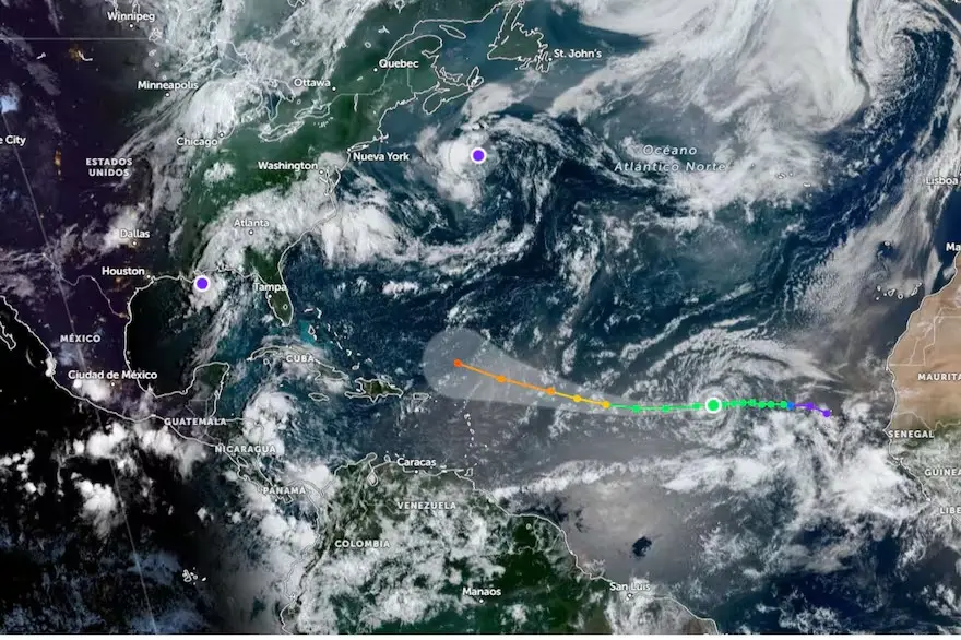
Santo Domingo.- The tropical storm “Erin” intensified this Wednesdaywhile advancing through the Atlantic, but the speed of its translation movement to the west has decreased, so its march has become slower.
The meteor It moves west to 17 miles per hour (27 kilometers), while heading towards the northeastern Antilles and Puerto Rico archipelago, Where it would happen as a hurricane.
At 6:00 p.m. on Wednesday, the system located In latitude 16.3 degrees, north, and length 45.0 degrees, westwith a maximum sustained wind of 50 miles per hour (80 kilometers).
An increase in Wave on the coast northeast of Dominican Republicbut said phenomenon no It represents direct danger For the Quequeyano territory.
The storm, the fifth of the hurricane season in the Atlantic and the Gulf of Mexico 2025, was formed last Monday on the coasts of the archipelago of Cabo Verde, in Africa.
He National Hurricane Center of the United States (CNH) He predicted that “Erin” will become a hurricane in the next few days, and then reach major category.
This is the fifth storm with a name, in a season that, in addition, records “Andrea“,”Barry“,”Chantal” and “Dexter”
The National Office of Oceanic and Atmospheric Administration (NOAA) modified, last week, its forecast for the current season, at the time it is in its most active cycle.
The previous forecast was 19 storms With names and nine hurricanes, but it was modified to 18 storms and nine hurricanes, Some major category.
Last year, 19 storms were formed with names and eleven hurricanes.
The Hurricanes season in the Atlantic basin It extends from June 1 to November 30.


