Santo Domingo.– The conditions of time in the Dominican Republic during the month of July were marked by the incidence of atmospheric phenomena, especially trough and tropical waves, according to reports from the forecast center of the Dominican Institute of Meteorology (INDOMET).
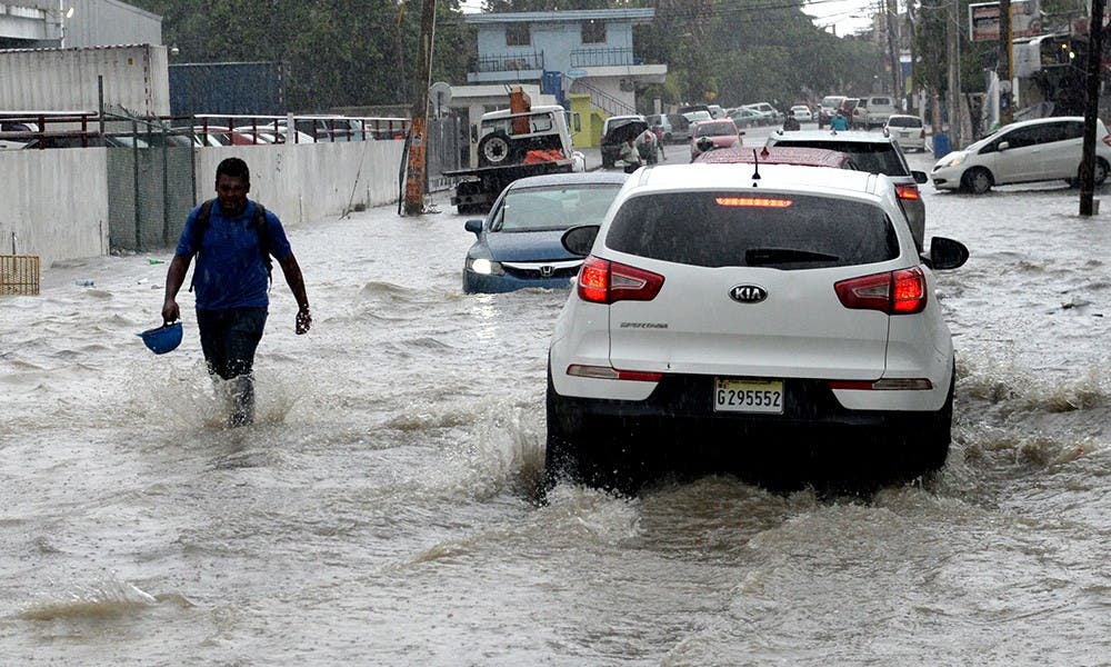
During 15 of the 31 days of the month, Vaguadas affected the country, causing rains in different sectors of the national territory. In addition, in six days the influence of tropical waves from the African coast was reported, transported by the winds in height and guided by the effect of Coriolis.
Julio in the Dominican Republic was marked by trough and tropical waves that caused significant rains
In at least four days, both phenomena – left and tropical waves – coincided, generating unstable conditions that motivated the emission of meteorological alerts for possible avocosorables and thunderstorms.
Sahara’s high pressure and dust
Also, in another four days high pressure systems predominated, which inhibited the formation of rain clouds, giving rise to skies already clear a high thermal sensation, which exceeded 35 degrees Celsius in different regions of the country.
On July 12 and 24, the presence of Sahara desert dust was recorded, also from Africa, which reduced the relative moisture of the air and limited the formation of rain, according to Indomet’s forecasts.
Persistent trough
From July 18 to 23, a trough remarked for five consecutive days, directly influencing the country’s weather conditions.
What are these phenomena?
- VAGUADA: It is an elongated area of low atmospheric pressure where masses of warm and humid air converge, which causes air promotions that favor the formation of clouds and rains. In meteorological terms, it represents an unstable area that can cover hundreds or thousands of kilometers, located between two high pressure regions.
- Tropical Wave: Also known as East waveit is an atmospheric disturbance that moves from east to west through the Atlantic Ocean. It is composed of an elongated strip of low pressure that generates cloudiness, downpours and thunderstorms, especially behind its axis. They are transported by Alisios winds and are common between May and November, a time of greater cyclonic activity.
Local impact
These tropical waves usually cause rains in various provinces of the country, including Altagracia, La Romana, San Pedro de Macorís, Santo Domingo, San Cristóbal, Peravia, Azua, Barahona and Pedernales.
