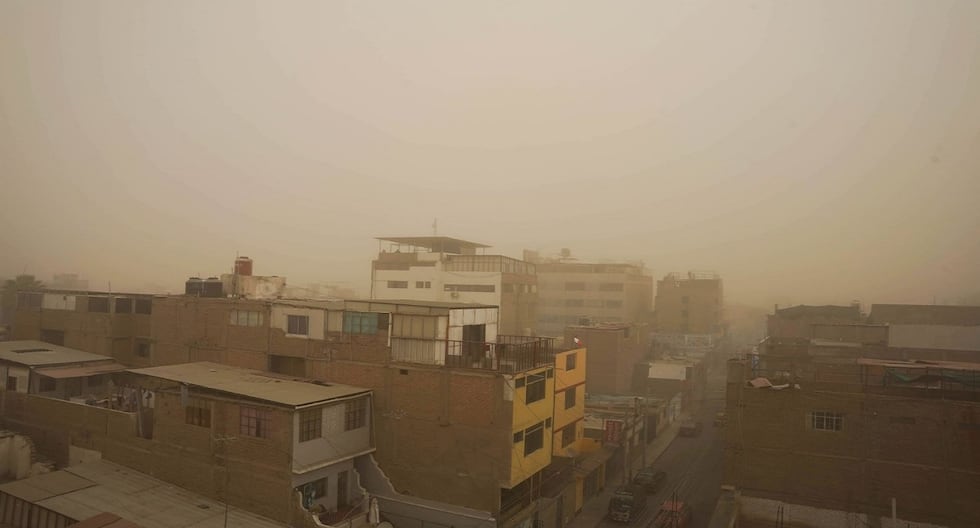
The National Meteorology and Hydrology Service of Peru (Senamhi) issued an orange alert due to the unusual increase of winds and sandstorm in the southern region, especially in Ica, where bursts reached up to 44 km/h.
This phenomenon has generated a storm of dust and dense sand in ICA, affecting locations such as Nasca, Paracas and Huacachina, and causing interruptions in outdoor activities and closing fishing coves.
In addition, strong winds and dust lifting impacted other southern regions such as Arequipa, Moquegua, Tacna, as well as in districts of Lima Metropolitana, generating dangerous conditions for health and road safety.
According to Senamhi, These intense winds will continue until Sunday, August 3, Mainly in the country’s coastal areas, with speeds that can reach 40 km/ho more, which can also decrease visibility and increase the sensation of cold.
According to the Rímac Monitoring Center, the winds will remain intense until Sunday, August 3, especially in the coastal areas of the country.
What is generating these sand storms?
This event is associated with the presence of the Pacific anticyclone, which intensifies coastal winds during winter. Factors such as:
- Cold sea temperature
- Atmospheric pressure differences between warm and cold areas
- Typical Paracas wind season (July-September)
- Health impacts: dust, sand and invisible risks
“Although the wind alone does not represent an immediate danger, its combination with suspension dust can cause respiratory crises, infections and accidents due to visibility reduction. It is key to protect the most vulnerable: children, older adults and people with respiratory diseases,” said Cinthya Arteta, deputy manager of Engineering, Prevention and Risk Management of Rímac.
Recommendations to protect yourself from winds with dust and sand
For the general population:
- Avoid getting out of home if it is not strictly necessary.
- Use masks, covers or wet cloths to protect the airways.
- Close doors and windows to avoid dust entry into homes or offices.
- Strengthen roofs, glass and light structures to avoid landslides.
- Be attentive to local authorities and follow official reports.
For drivers:
- Reduce speed and drive with caution in affected areas.
- Avoid long trips if they are not essential.
- Light flashing lights in reduced visibility sections.
- Be alert to the possible fall of trees, posts or road panels.
Forecast: When does the strong wind end?
From August 1 to 3, winds will continue to affect coastal regions. In addition, the presence of dust in suspended and reduced visibility in the Panamericana Sur and Norte, as well as fog and light drizzle in the mornings and nights, which intensifies the thermal sensation of cold.
Regions and provinces under strong winds
The prognosis indicates wind speeds greater than 30 km/h throughout the Peruvian coast:
- Ica: Ica, Chincha, Nasca, Palpa and Pisco
- La Libertad: Trujillo, Ascope, Chepén, Pacasmayo and Virú
- Lambayeque: Chiclayo and Lambayeque
- Lima: Lima, Barranca, Cañete, Huaral and Huaura
- Piura: Piura, Paita, Sullana, Talara and Sechura
- Áncash: Casma, Huarmey and Santa
- Arequipa: Camaná, Caravelí and Islay
- Callao: Constitutional Province of Callao
