By Elizabeth Salazar and Geraldine Santos
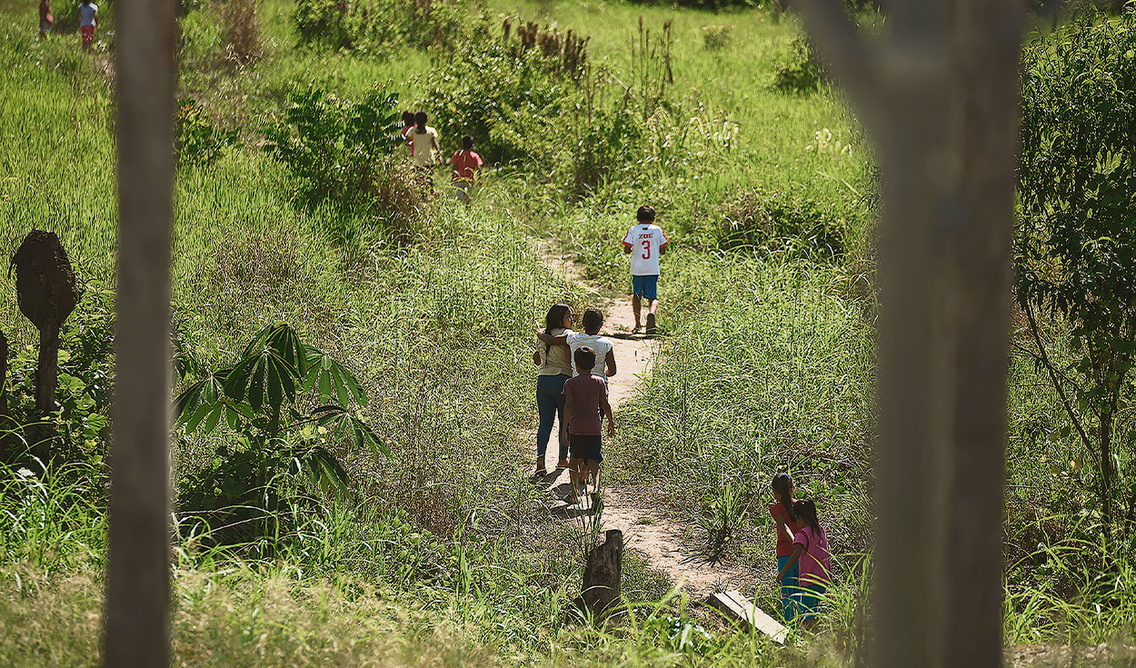
In the Amazonian hamlets of the Huánuco region, where the days are short due to the lack of electricity, a cell phone ringing around midnight is almost always a sign of a bad omen. Edgar – we will call him that for safety – answered sleepily. He barely managed to hear the voice on the other end of the line before it went dead, but the message was clear: he was being watched. The interlocutor knew that the next day some people would come to his farm and ordered him to cancel the meeting because ‘his neighbor’ did not want visitors. That neighbor is a clandestine landing strip built by drug trafficking to send drugs to Bolivia and Brazil. An open crack in the forest inhabited by the last Kakataibo indigenous people of Peru.
This people with a warrior tradition lives between the regions of Huánuco, Ucayali and Loreto, around the North and South Kakataibo Indigenous Reserve, an intangible area where indigenous people of the same ethnic group live in voluntary isolation, and which was only recognized by the government in 2021. Since the pandemic, invaders and criminal networks have spread in the area, claiming the lives of the Kakataibo who fight to protect their lands. Only in the Kakataibo Sur sector, which crosses the districts of Codo del Pozuzo (Huánuco) and Padre Abad (Ucayali), five of its inhabitants have been murdered since 2020 after receiving threats from drug trafficking.
This report exposes the promoters of the dispossession of the Kakataibo Sur jungle, where there are six native communities: Santa Martha, Sinchi Roca I, Sinchi Roca II, Puerto Nuevo, Unipacuyacu and Puerto Azul. The crossing of georeferenced data, obtained through requests for access to information and the scraping of public portals and civil society platforms, shows the damage caused by invaders and organized crime, but also the responsibility of the State in continuing to grant extractive permits and private titles in a territory that historically belongs to indigenous people.
YOU CAN SEE: Anemia threatens the children of the Amazon and new strategies are urgently needed
Narcopists and new mining concessions
In this portion of the Amazon, illegals have built 11 clandestine landing strips. Three of the illegal airfields are located just 12 and 8 kilometers away from the Regional Conservation Area, on the banks of the Pozuzo River. This location allows them to connect with trail roads along which drugs are transported from the provincial capital of Puerto Inca.
Drug trafficking built its fourth and fifth runway in the expansion area requested by Puerto Azul, while a sixth illegal airfield is located within the native community of Puerto Nuevo, on the border with the Kakataibo Sur Indigenous Reserve. The last five clues are scattered within the area that the Santa Martha community managed to title and the territory that its leaders claim as an expansion zone.
For three decades, illegal plantations have spread in all Kakataibo towns and today they are present even within the Indigenous Reserve, especially in the section that borders the Puerto Azul expansion area to the border with the native community of Unipacuyacu, the only one that has not been titled.
YOU CAN SEE: Weaving Citizenship debates challenges of the Amazon
The loss of forest cover in these forests is due to illicit coca crops, and the presence of illegal loggers, farmers and ranchers who plant grasslands to feed their animals. At least 19.3% of the 275,203 hectares occupied by the native communities, their expansion areas, the Regional Conservation Area and the Kakataibo South Reserve are deforested.
The State adds to the impact caused by invaders and illicit activities: in the area analyzed there are two oil concessions and one forestry concession in force, granted before the recognition of the Kakataibo Sur Reserve, but satellite images and analyzed documents confirm that the State approved four mining concessions in this territory when its intangible nature had already been declared.
These four mining concessions that overlap with the Kakataibo Sur Indigenous Reserve and the Unipacuyacu native community, were authorized by Henry Luna Córdova, president of the Geological, Mining and Metallurgical Institute (Ingemmet); and by Vilma Vilcas Melchor, from the Regional Directorate of Energy and Mines of Huánuco, between May 2023 and July 2024. The total area is 2,000 hectares.
YOU CAN SEE: The unknown border between Peru and Ecuador that has little traffic and presence of illegal mining
Within Unipacuyacu we identified a mining concession request that overlaps with 400 hectares of the native community, and another request for 100 hectares that partially crosses the Indigenous Reserve. Three requests were also identified within the territory titled by the native community of Puerto Azul, another six in its adjacent forests and in the area requested as an expansion, and one more that crosses the community of Puerto Nuevo.
Unipacuyacu is the only one of the Kakataibo towns that has not been titled. The process has been filed in the Regional Government of Huánuco for almost three decades. Their ancestral territory includes 22,946 hectares, but land trafficking, drug trafficking and illegal logging have limited them to 0.01% of this area. “There are roads that we cannot pass because there are armed people. “They have stripped us of our own land,” says one of the community members.
They keep alive the memory of their leader Arbildo Meléndez, active promoter of the Unipacuyacu titling, and the first environmental defender murdered during the pandemic. In 2008, the then mayor of Puerto Inca, Leonidas Núñez Vera, created the Nueva Libertad population center within the community’s territory and, with this, allowed the advancement of ranchers and farmers. Today, satellite data and maps from Devida show that illegal plantations have expanded in the occupied zone.
YOU CAN SEE: Naturally Divine, the Peruvian startup that saved the exotic Amazonian fruit from extinction and received a UN award
The businessman with the most land
Santa Martha was the third Kakataibo community to obtain a title and the only one that this ethnic group obtained in Huánuco. In 1986, the indigenous leaders registered 14,699 hectares of their ancestral territory and six years later, in 1992, they asked for an extension of 18,596 hectares, but almost in parallel, said territory became an area of dispute: indigenous people and foreigners began to parcel out and sell the land. lots without proving possession.
Data from the Cadastral System for Rural Property (Sicar) of the Ministry of Agrarian Development and Irrigation reveal that 91.7% of the Santa Martha expansion area has already been handed over to third parties. In total, 318 properties obtained their registration in Public Registries and in the rural cadastre of Huánuco.
According to our georeferential analysis, the owner of the largest number of hectares in this Santa Martha expansion zone is Ricardo Cillóniz Champín, executive president of Corporación Aceros Arequipa, the main steel company in Peru. Aceros Arequipa does not have investments in Huánuco, but one of its partners does: Celepsa, a subsidiary of the Unacem group that operates the Marañón Hydroelectric Power Plant in this region through its subsidiary Celepsa Renovables SRL. In fact, Cilloniz Champín is a member of the board of directors of Celepsa. and Aceros Arequipa owns 10% of shares.
YOU CAN SEE: Let’s intensify the fight against climate change: Hydrocarbons and rights in the Amazon
Ricardo Cillóniz owns two plots in the area claimed by the Kakataibo of Santa Martha: one measures 790.3 hectares and the other 17.9 hectares. Only the extension of the first is twice the Lima district of Magdalena. Although others own up to seven plots of land in the same sector, they do not measure even half of the businessman’s 808 hectares.
Cilloniz and his neighbors became owners of these lands within the framework of the massive titling campaign promoted by the Regional Government of Huánuco. Said entity awarded supposedly free lands and registered them in Public Registries. Then he divided them in favor of 13 people: loggers, ranchers and the aforementioned businessman. To carry out this procedure, they had to demonstrate that they occupied these lands, but there is no information about this in the Puerto Inca archives. The delivery of the properties took place between 2014 and 2015, during the administrations of current congressman Luis Picón Quedo and Rubén Alva Ochoa. Neither the businessman nor the former governors responded to our interview requests.
The Agrarian Agency of the province of Puerto Inca is the one that processes the possession certificates in Huánuco. However, their files are stored on old wooden shelves or on the floor. There are pages covered in cobwebs and rodent excrement, others have ink smeared by the rain that leaks from the ceiling. It is impossible to know the identity of all those who commercialized the lands claimed by the Kakataibo of Santa Martha.
