AREQUIPA, Peru – Starting this weekend, and throughout next week, very favorable conditions for precipitation will prevail throughout the country, a situation that keeps Cuban authorities on alert.
Less than a month after Hurricane Oscar passed through the east of the Island, the general director of the National Institute of Meteorology (INSMET), Celso Pazos Alberdi, pointed out that the main assessment is aimed at the phenomenon of rain: “We maintain total surveillance,” he stressed.
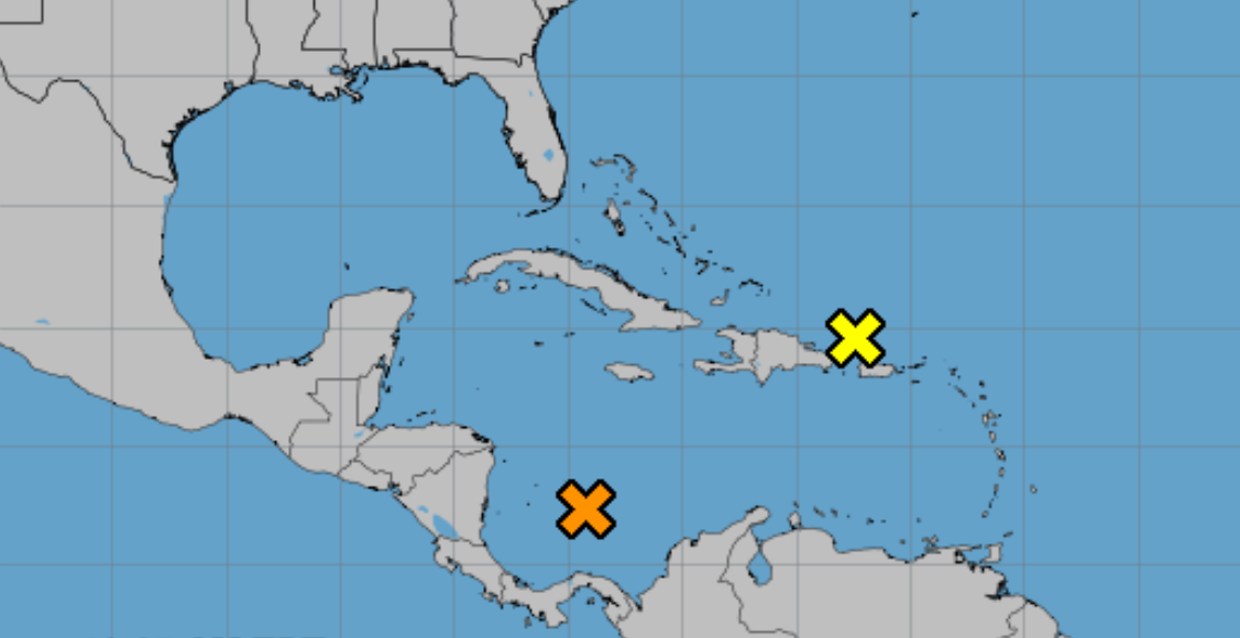
In a meeting from the Palace of the Revolution where the ruler Miguel Díaz-Canel and other leaders of the Cuban regime also participated, the INSMET director offered an explanation about two areas included in the general satellite image.
On Friday afternoon, Pazos Alberdi said that observations are being made on the first one, located north of the Lesser Antilles, which continues to extend from that area to the Atlantic Ocean.
The expert spoke in terms of an “area of interest, although with a low probability of development,” which causes conditions of “disturbed weather, showers, rain, and thunderstorms.” Much of these clouds, he explained, will continue moving west and west-northwest, and will be approaching to the eastern region from Cuba.
The above means, he stated, that starting this Saturday afternoon cloudiness and the probability of precipitation will increase again, which will increase at the height of Sunday. Regarding this forecast, Díaz-Canel warned that the land is already saturated with water.
Regarding the second area, Celso Pazos pointed out that it is “the one that remains in the south of the Caribbean Sea,” which was large but very disorganized, “although today (Friday) the forecast models give it a greater probability of development.” ”.
It is expected, according to the manager, that in the coming days a low pressure center will appear in that area, whose general movement would occur between the north and the northwest; which, in any case, would bring the meteorological phenomenon closer to the southern coast of Cuban territory.
Precipitation and a possible tropical depression
He National Hurricane Center (NHC) and the Cuban Meteorological Institute (INSMET) reported this Friday on the high probability of a tropical depression developing in the southwest of the Caribbean Sea during the next few days.
The system could form from a broad area of low pressure that is likely to develop over the next 12 to 24 hours.
According to the NHC, in its outlook issued at 2:00 pm this Friday, “gradual development is possible thereafter, and a tropical depression is likely to form late this weekend or early next weekend.” week as the system moves generally northward or northwestward over the central or western Caribbean Sea.”
The probability of formation up to seven days, according to the NHC, is high (70%).
