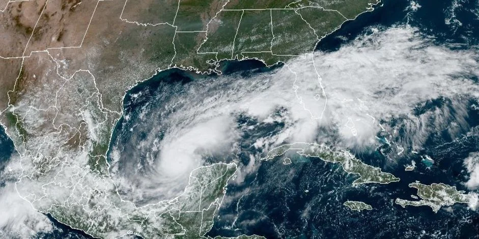
MIAMI, United States. – Hurricane Milton has rapidly intensified to reach category 5 on the Saffir-Simpson scale, according to the most recent newsletter issued by the National Hurricane Center (NHC) of the United States.
With sustained winds of 250 km/h and a translation speed of 15 km/h), the cyclonic organism continues to move east-southeast, towards the west coast of Florida.
At 10:00 a.m., Milton was approximately 200 km west of Progreso, Mexico, and 1,175 km southwest of tampaFlorida. The phenomenon is expected to move near the Yucatan Peninsula this Monday and Tuesday before heading towards the west coast of the Florida Peninsula in the middle of the week.
Currently, there is a hurricane warning for coastal areas of Mexico from Celestún to Río Lagartos, while in Florida, hurricane watches have been issued for the Gulf Coast, including Tampa Bay and Lake Okeechobee. Additionally, a storm surge watch is in effect for several points along the Florida coast, where sea levels are expected to rise between 8 and 12 feet in some areas such as Tampa Bay.
The NHC also warned of the possibility of storm surge that could cause dangerous flooding in coastal areas. “The water could reach heights of up to 12 feet above ground level in the areas affected by the surge,” the scientific entity’s bulletin states.
Likewise, heavy rains of between 5 and 10 inches are expected in parts of Florida and its southern keys, with local accumulations of up to 15 inches, which could cause flash flooding.
Milton is the 13th named tropical cyclone to form in the 2024 Atlantic Ocean cyclone season.
In late May, the US National Oceanic and Atmospheric Administration predicted there would be between 17 and 25 named tropical cyclones this year, a number that is above average.


