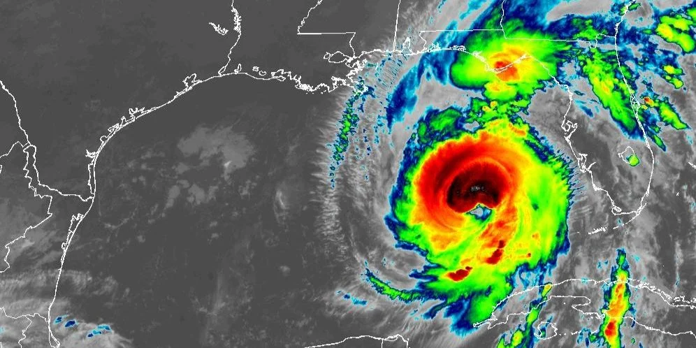
MIAMI, United States. – Hurricane Helene, which is expected to reach Category 4 before making landfall, threatens the coast of Florida with winds of up to 251 km/h and could cause “devastating” damage in the region, according to National Hurricane Center forecasts (NHC) of the United States.
According to Reuters agency reportJamie Rhome, deputy director of the NHC, warned of the severity of the impact: “For those in the path, that unfortunately means catastrophic winds.”
Helene entered the Gulf of Mexico on Wednesday and has gained strength due to warm waters in the region, with landfall forecast for Thursday night in the Big Bend area of Florida.
In addition to the strong winds, a storm surge of up to 20 feet (6 meters) is expected in the Big Bend area, which could exacerbate flooding.
Rhome noted that the greatest risk to human life during a hurricane typically comes from flash flooding, which often sweeps away people in their vehicles as they try to cross flooded roads.
Authorities have issued evacuation orders in multiple Florida counties, including Sarasota and Charlotte. Gov. Ron DeSantis urged residents to prepare: “You still have time to review and execute your hurricane preparedness plan,” he said.
In the United States, in addition to the threat to coastal communities, Georgia’s agricultural areas are expected to suffer severe losses. “This is going to be a $1 billion disaster,” Pam Knox, an agricultural climatologist at the University of Georgia, told Reuters.
In Cuba, the hurricane has already left heavy rains with accumulations of up to 20 cm in Pinar del Río, according to reports from the Island’s Institute of Meteorology (INSMET).
At 6:00 am the center of the Hurricane Helene It was located at 24.3 degrees north latitude and 86.1 degrees west longitude, which placed it about 300 kilometers northwest of Cape San Antonio, the westernmost point of Cuba, and 535 kilometers southwest of Tampa, Florida.
Helene has maintained a north-northeastward course, moving at a speed of 19 kilometers per hour. It is expected to continue its path east of the Gulf of Mexico, increasing both its speed and intensity.
During the early morning, sustained winds of 60 kilometers per hour were reported at the Casablanca meteorological station in Havana. In Santa Lucía, Pinar del Río, gusts of up to 101 kilometers per hour were recorded, while in Casablanca they reached 92 kilometers per hour.
In the early morning hours, rain continued in the western and central regions of the country, with greater intensity in the west, where heavy and intense rainfall is expected in some localities. In addition, southerly winds in the western region are blowing at speeds of between 40 and 55 kilometers per hour, with higher gusts.
INSMET also warned that storm surges continue to affect the southern coast of the provinces from Pinar del Río to Sancti Spíritus.. Light to moderate coastal flooding has been reported on the southwestern coast, with a risk of worsening in the coming hours.


