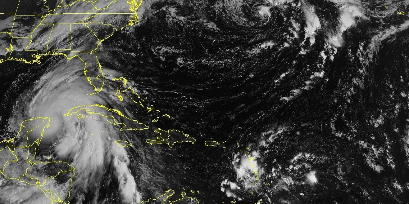
MIAMI, United States. – Tropical storm Helene, located near the northeast coast of the Yucatan Peninsula and 160 kilometers from the western tip of Cuba, is close to becoming a hurricane, reported the National Hurricane Center (NHC) of the United States in Your 7:00 am bulletin this Wednesday.
Helene is registering sustained winds of 110 km/h, which puts it on the verge of reaching hurricane category, a threshold that it could exceed in the next few hours. “Additional strengthening is expected, and Helene could become a hurricane later today.” [miércoles]”, the NHC said.
The US agency issued a hurricane warning for the Cuban province of Pine Forest of the Riverwhile Artemisa and the special municipality of Isla de la Juventud are under a tropical storm alert. According to the report, Helene is expected to bring with it intense rains that could accumulate between 100 to 200 millimeters, with isolated maximums of up to 300 mm, which increases the risk of major flooding in western Cuba.
The NHC warns that “the combination of storm surge and tide could raise water levels up to two to four feet above normal” on the southern coasts of Pinar del Río and Isla de la Juventud.
The storm is moving northwest at 15 km/h and is expected to maintain this path through Wednesday morning before turning northward later in the day. Helene will move across the eastern Gulf of Mexico and reach the Florida coast on Thursday night, when it is expected to become a major hurricane.
“Regardless of the development and future trajectory, heavy rainfall is expected in western and central Cuba starting in the evening of Tuesday 24,” the bulletin said.
The NHC also notes that Helene will generate “swells that will affect the southern coast of Cuba” and will cause waves that could be dangerous. In addition, tropical storm conditions, with strong winds, are expected in Cuba within the next few hours, while hurricane conditions could reach the western portion of the island later today.


