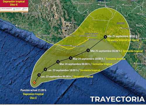
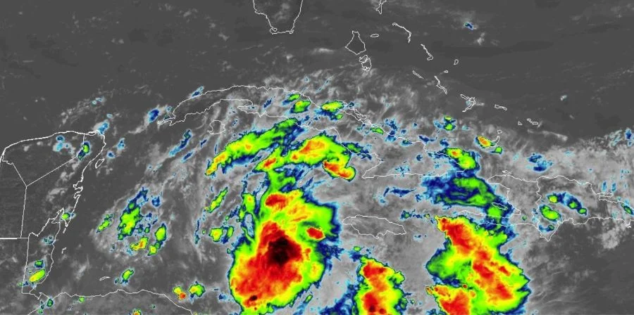
▲ As of last night, the tropical depression was still heading northwest and is expected to become a tropical storm.Photo Conagua
From the Editorial Staff
The newspaper La Jornada
Monday, September 23, 2024, p. 9
The National Water Commission (Conagua) reported that the cloud bands of tropical depression 10-E, which was located off the coast of the southern Pacific last night, will cause intense rains (75 to 150 millimeters) in Chiapas, Guerrero and Oaxaca, as well as winds with gusts of 50 to 70 kilometers per hour, waves of one to 3 meters high and possible waterspouts in coastal areas of said states.
Tropical storm is expected to form on Monday Johnwhich is why the Guerrero Education Secretariat announced that classes are suspended in Acapulco and the Costa Chica, while Civil Protection urged people to stay informed about the evolution of the meteor.
In other parts of the country, low pressure channels will remain over the northwest, west, center and southeast, in combination with the entry of humidity from the Pacific, Gulf of Mexico and Caribbean Sea, so there will be heavy rains in Tabasco, very heavy in Campeche, Puebla, Quintana Roo, Veracruz and Yucatan, and heavy in Mexico City, Colima, Durango, State of Mexico, Jalisco, Michoacan, Morelos and Nayarit.
On the other hand, cold front 3 will enter the country through the northern border, which will interact with a low pressure channel in the northeast, which will generate very heavy rains and possible hail in Coahuila, as well as strong rains in Chihuahua, Nuevo León, San Luis Potosí and Tamaulipas.
Winds with gusts of 50 to 70 kilometres per hour and possible whirlwinds or tornadoes are also expected.
For today, the National Meteorological Service of Conagua forecast that minimum temperatures will be from zero to 5 degrees in high areas of Baja California, Chihuahua, the State of Mexico, Hidalgo, Michoacán, Puebla, Sonora and Tlaxcala.
In the afternoon, highs will be 40 to 45 degrees in Baja California and Sonora; 35 to 40 in Baja California Sur, Chihuahua, Coahuila, Colima, Durango, Jalisco, Michoacan, Nayarit, Nuevo Leon, San Luis Potosi, Sinaloa, Tamaulipas and Zacatecas, and 30 to 35 degrees in Campeche, Chiapas, Guerrero, Morelos, Oaxaca, Quintana Roo, Tabasco, Veracruz and Yucatan.
The rains forecast for today and tomorrow could cause flooding, landslides, increased levels of rivers and streams, as well as overflows and flooding in low-lying areas of these states.


