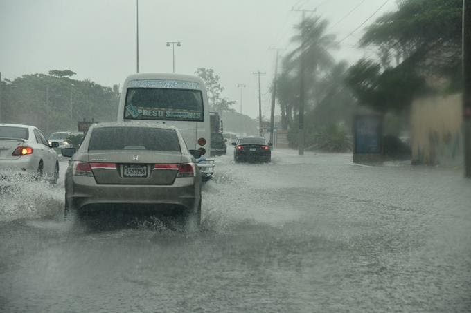
The Emergency Operations Center (COE), issued this Wednesday green alert for seven provinces and the National District by a trough located at different levels of the troposphere, which has generated cloudy clouds with moderate to heavy downpours at times, electrical storms and gusts of wind over the north, northeast, east, southeast and Central Cordillera regions.
In this sense, the COE issued an alert for the provinces of María Trinidad Sánchez, San Cristóbal, Santo Domingo, Samaná, Hato Mayor, El Seibo, La Altagracia and the National District due to possible flooding of rivers, streams and ravines, as well as urban flooding. and sudden.
It is recalled that, as established by the COE, the green alert is one that is declared when the expectations of a phenomenon
allow to anticipate the occurrence of an event of a dangerous nature for the population. It may be partial or total.
In this sense, the COE called on the population to follow the guidelines and orientations of the civil protection organizations, in addition to keeping in contact with the Civil Defense, the Armed Forces, the Red Cross, the National Police, the Fire Department and the same institution through the different ways of accessing information.
ONAMET joins COE predictions
Read more: Lettuce contains toxic substances from tires, according to a study
In addition to what is established by the COE, and according to the National Meteorology Office (ONAMET), the trough observed at various levels of the troposphere in the eastern portion of the country and the effects of the prevailing east/northeast wind will contribute notably in the increase in humidity over the Dominican territory, causing the presence of temporary and isolated rains.
For Thursday and Friday, the weather conditions will continue to be favorable for the occurrence of downpours, electrical storms, and occasional gusts of wind, especially in towns in the north, northeast, and southeast regions (including Greater Santo Domingo), the Central Cordillera, and the border, where rainfall is expected to be more frequent and intense. This is due to the direct effects of the trough that will be over the country and the movement of clouds that will cause the prevailing wind from the east/northeast.
The temperatures will become especially pleasant at night and early morning, due to the northeast wind and the time of year (winter), with a minimum between 6°C Y 12°C in mountainous areas such as: Constanza, Jarabacoa, Hondo Valle, Polo, among others, and may be of 4°C Y -2°C in higher altitude areas, such as Valle Nuevo or Pico Duarte.


