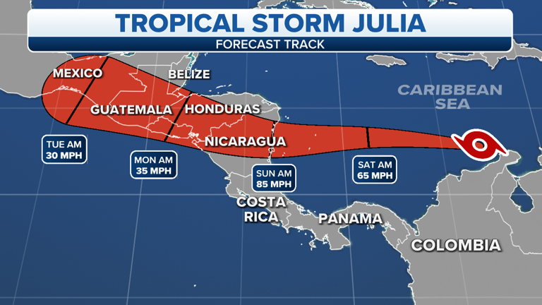
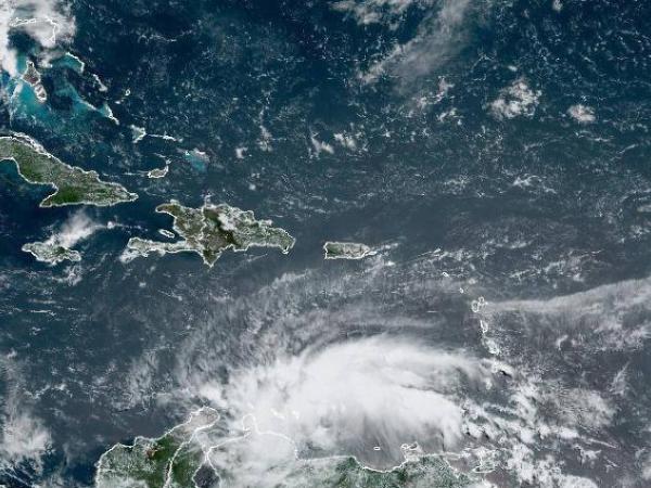
Tropical Storm Julia formed in the southern Caribbean Sea and is expected to intensify into a hurricane over the weekend as it moves toward Central America, where it will pose a serious flooding threat early next week.
Julia is the 10th named storm in the Atlantic Basin this season. It will become the fifth hurricane if its winds reach at least 74mph/119kmph. The National Hurricane Center expects this to happen on Saturday night.
The meteor is centered more than 100 miles/160 km west of the northern tip of the Guajira Peninsula, Colombia, and just over 500 miles/804 km east of Providencia Island, Colombia.
It has maximum sustained winds of 40 mph/64 kmph and is moving west about 18 mph/29 kmph. It is forecast to intensify along its path across the southwestern Caribbean Sea, likely becoming a hurricane by Saturday night.
It is expected to move in that area through Saturday. It will then pass near the Colombian islands of San Andres and Isla de Providencia before making landfall along the Nicaraguan coast on Sunday morning.
After moving inland into Nicaragua, Julia will weaken as it turns west-northwestward and moves across other parts of Central America through Monday.
The Atlantic hurricane season has just under two months left. October ranks as the third busiest (after September and August) for tropical activity in the Atlantic basin, typically producing about two named storms each year, one of which becomes a hurricane.


