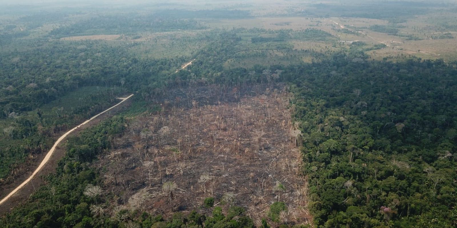
Forest vegetation and grassland vegetation in Brazil suffered the greatest area losses between 2000 and 2020, while managed pasture, agricultural area and forestry showed the greatest increases.
The survey Environmental Economic Accounts of the Earth: Physical Accounting (Brazil 2000/2020), released today (7) by the Brazilian Institute of Geography and Statistics (IBGE), shows that 64.7% of the changes that occurred were on native vegetation, a regression resulting from , especially, the advance of pasture with management and farming.
“It is evident that, since 2000, the classes with the highest participation in total conversions were those of forest vegetation (40.4%), grassland vegetation (24.3%) and mosaic of occupations in forest areas (19.2% ). When considering only the classes of native vegetation, it is noted that more than half of the conversions that took place in the country in the period studied were on forest and grassland vegetation (64.7%)”, says the study.
From 2000 to 2020, the country’s grassland vegetation decreased by 10.6% (192.5 thousand square kilometers) while forest vegetation decreased by 7.9% (320.7 thousand km²). Together, these two types of coverage lost 513.1 thousand (square kilometers) km² between 2000 and 2020, equivalent to 6% of the country’s territory.
In the same period (2000/2020), the area of forestry in the country grew by 71.4% (36 thousand km²), the agricultural area increased by 50.1% (229.9 thousand km²) and that of managed pasture, 27, 9% (247 thousand km²).
The most intense changes occurred in the edges of the Amazon, in Matopiba, in the south of Rio Grande do Sul and in the area that goes from the west of São Paulo to the east of Mato Grosso do Sul and Goiás. Matopiba is a region of great growth in the cultivation of grains, whose name is the combination of the acronyms of the states that have cities in the region: Maranhão, Tocantins, Piauí and Bahia.
According to the IBGE, the difference between the years 2000 and 2020 indicates that important conversions from use to agricultural activity took place on the so-called agricultural frontier of Brazil. In different regions of the country, but especially in the Cerrado biome, new areas were converted into cultivation, many of them derived from pastures, in general with some degree of degradation.
“These areas had their use converted under the influence of favorable climate, soil and relief conditions, considering the possibilities of expansion of agricultural activity with the use of machines and the existence of an infrastructure for the flow of production (roads, railways, ports, waterways). In some cases, the price of land is also pointed out as an attraction factor”, informs the research.
The manager of environmental accounts at IBGE, Ivone Batista, said that, in general, the researchers observed the course of changes from native vegetation to managed pasture and, some time later, this pasture is converted to agriculture. She highlighted, however, that this dynamic is not homogeneous in the national territory, because, many times, the native vegetation is cut down to make way for crops directly, as is the case in the Cerrado.
“The economic dynamic is what moves the areas and changes the landscape, but at the cost of losing native areas,” said Ivone.
According to the survey, agricultural areas stand out especially in the states of Mato Grosso (18.1%), São Paulo (14.9%), Rio Grande do Sul (14.3%) and Paraná (10.5 %) with the highest percentages of land in this class, in relation to the total Brazil.
Crops also grew in Maranhão (2.8%), Tocantins (4.4%), Piauí (3.8%) and Bahia (2.7%), which are part of Matopiba, from 2000 to 2020.
Pará was the federation unit with the greatest expansion of managed pasture: 87.8 thousand km²; and with a greater reduction of natural vegetation, 123.2 thousand km².
From 2018 to 2020, 70 thousand km² of the country underwent some change in land cover and use, corresponding to 0.7% of the national territory, or an area equivalent to that of Alagoas and Rio de Janeiro. The data appears in the publication Monitoring Land Cover and Use of Brazil (2018-2020) also released this Friday.
In this period (2018/2020), the main conversions were from pasture with management to agricultural area (14.9 thousand km²), from mosaic of occupations in forest area to pasture with management (12.3 thousand km²) and from forest vegetation to mosaic of occupations in a forest area (11.8 thousand km²).
